

Lower Lam Tsuen River
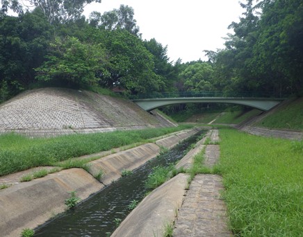
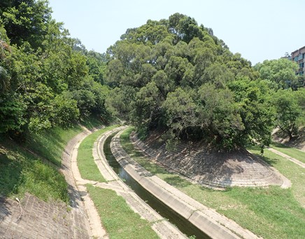
Lower Lam Tsuen River is located at Tai Po. It drains water from the Lam Tsuen Valley, and then flows eastward into Tolo Harbour. The channelized river comprises of grassed cellular concrete river bed and tree islands. DSD started an ecological enhancement site trial in the section near Mui Shue Hang Playground in late 2015. The details of the site trial are presented in the Site Trial section.
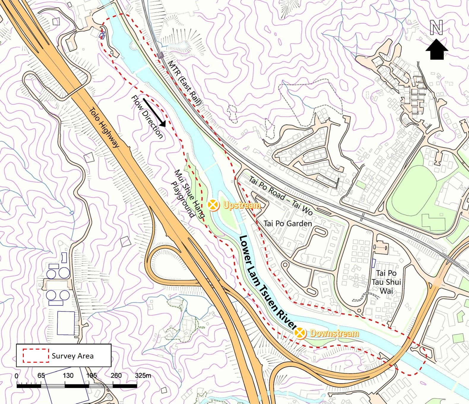


Lower Lam Tsuen River Upstream
pH
If the result is under detection limit, it would be presented as detection limit in the charts.
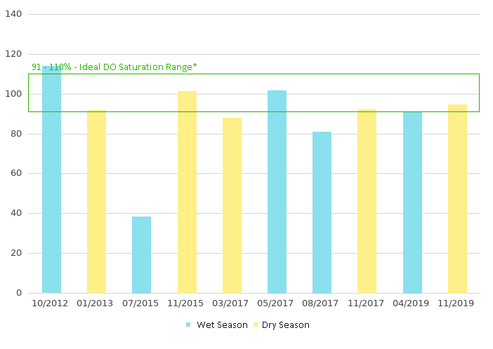
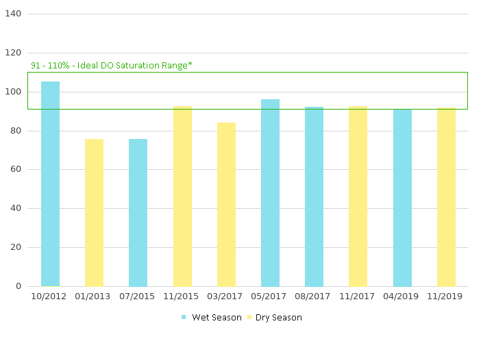
Dissolved Oxygen - Saturation (% )
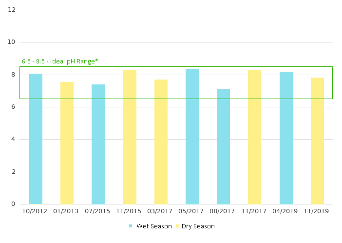
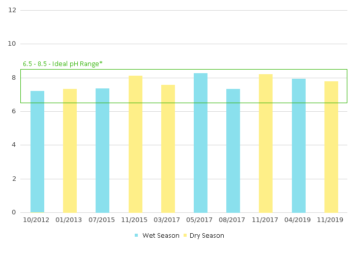
pH
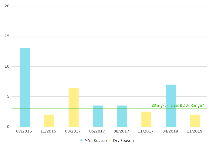
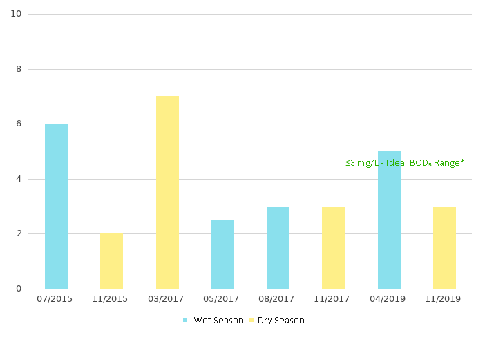
5-day Biochemical Oxygen Demand (mg/L)
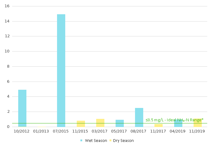
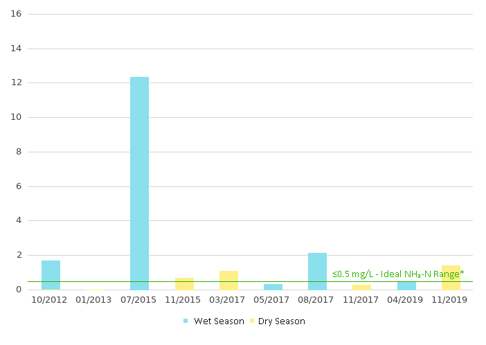
Ammonia as N(mg/L)
Dissolved Oxygen (DO) indicates the total amount of oxygen dissolved in the river channel water. DO supports aquatic fauna for respiration and maintenance of life. Dissolved Oxygen Saturation (DO (%)) falling in to 91 – 110% means excellent water quality with dissolved oxygen near or at saturation
Provides indication of anthropogenic pollutants. pH falling into 6.5–8.5 indicating that there is unpolluted surface water supporting most of the aquatic biota.
5-day Biochemical Oxygen Demand (BOD5) is the measure of the amount of dissolved oxygen consumed to break down organic material in five days by biological processes. High BOD5 level indicates water pollution. BOD5≤3 mg/L indicates excellent water quality
Ammonia-Nitrogen (NH3-N) Indicates the extent of organic contamination of the river channel. NH3-N < 0.5mg/L means that there is limited contamination by nutrient