

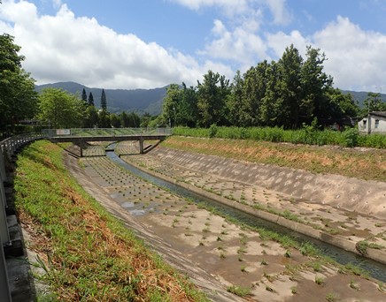
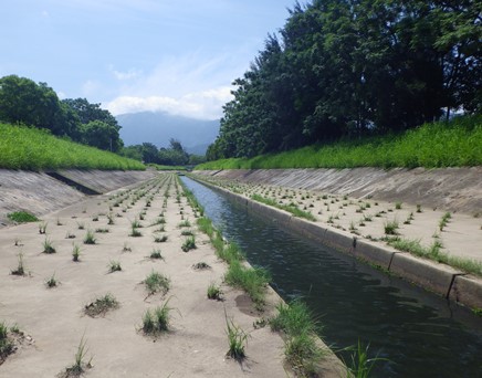
Kam Tin River South
Kam Tin River South is located at Yuen Long in the northwest New Territories. It collects water from Shek Kong Stream and Kap Lung stream. It joins Kam Tin River North into Kam Tin River Main. It was channelized in 2003.
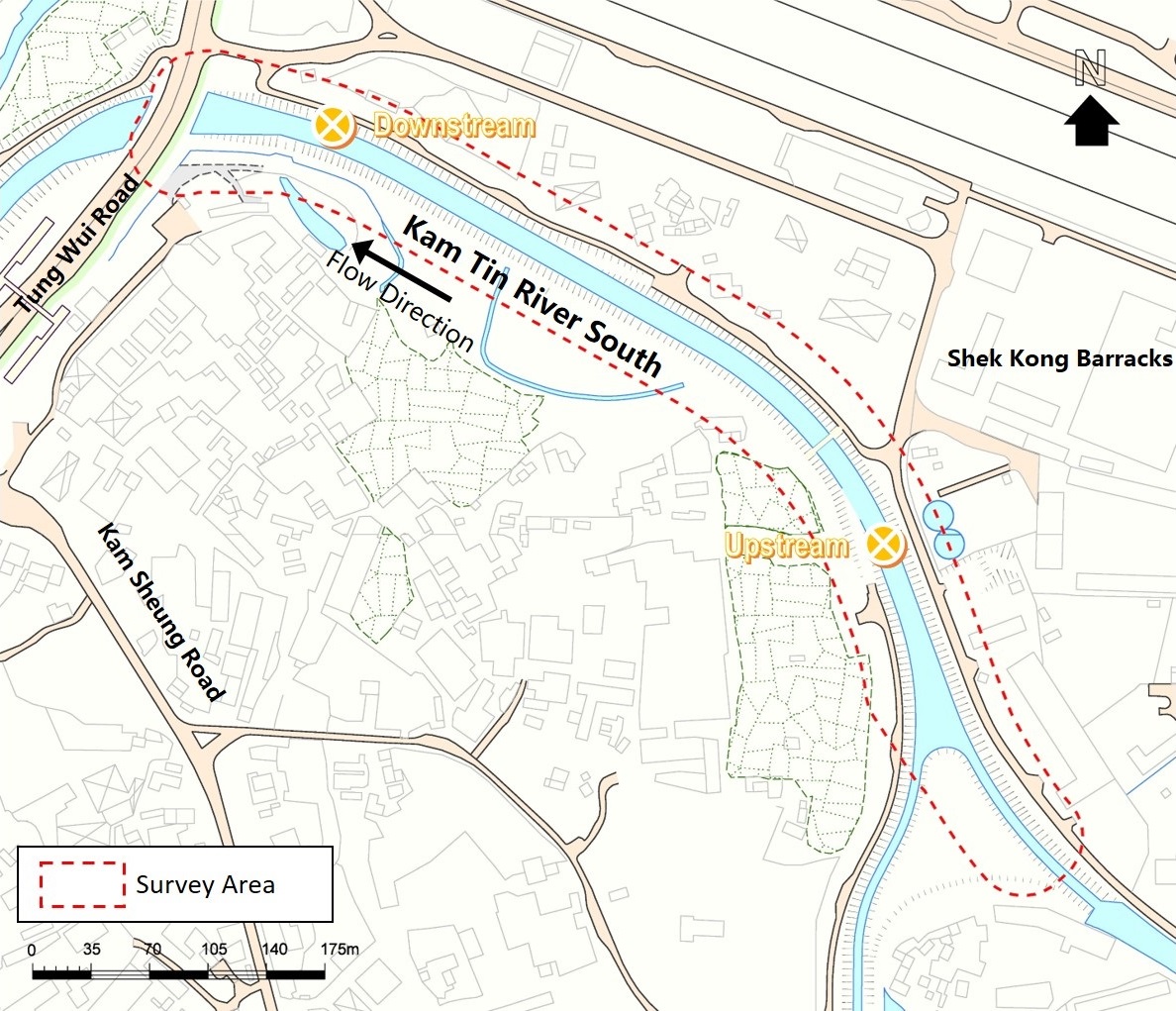


Kam Tin River South Upstream
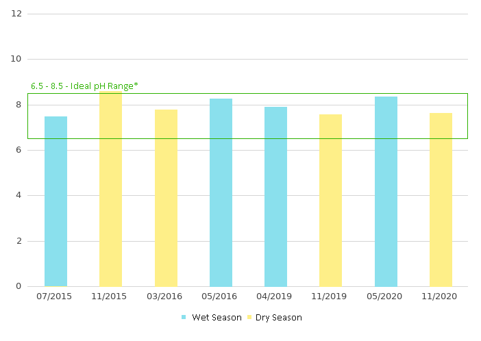
pH
If the result is under detection limit, it would be presented as detection limit in the charts.
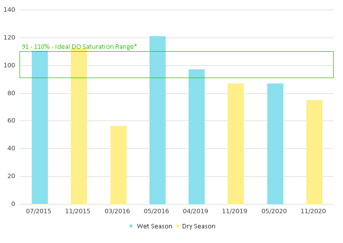
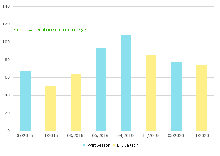
Dissolved Oxygen - Saturation (% )
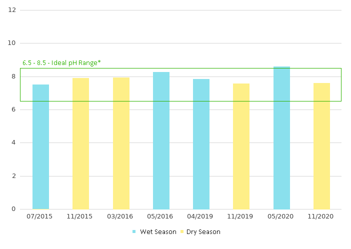
pH
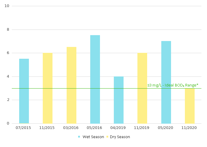
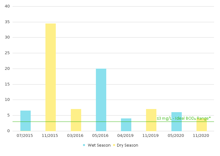
5-day Biochemical Oxygen Demand (mg/L)
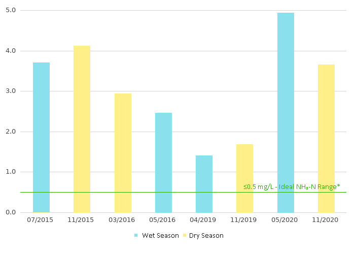
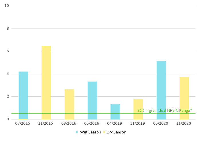
Ammonia as N(mg/L)
Dissolved Oxygen (DO) indicates the total amount of oxygen dissolved in the river channel water. DO supports aquatic fauna for respiration and maintenance of life. Dissolved Oxygen Saturation (DO (%)) falling in to 91 – 110% means excellent water quality with dissolved oxygen near or at saturation
Provides indication of anthropogenic pollutants. pH falling into 6.5–8.5 indicating that there is unpolluted surface water supporting most of the aquatic biota.
5-day Biochemical Oxygen Demand (BOD5) is the measure of the amount of dissolved oxygen consumed to break down organic material in five days by biological processes. High BOD5 level indicates water pollution. BOD5≤3 mg/L indicates excellent water quality
Ammonia-Nitrogen (NH3-N) Indicates the extent of organic contamination of the river channel. NH3-N < 0.5mg/L means that there is limited contamination by nutrient