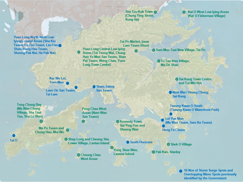
In order to comprehensively review the impacts of storm surges and waves on coastal low-lying or windy locations under extreme weather and climate change, the Government completed the Study of Coastal Hazards under Climate Change and Extreme Weather and Formulation of Improvement Measures - Feasibility Study (Coastal Hazards Study). It identified 26 coastal low-lying or windy residential areas* with higher risks (for details see the plan below) for formulation of the necessary improvement works and management measures to safeguard public safety.
Location Plan

Improvement Measures
The improvement works comprise various protective and adaptive options, which may include constructing or raising wave walls along the coastline, installing flood barriers at suitable places behind the coastline to cut off water pathways towards inland areas, and/or installing demountable flood barriers at building frontages. Management measures involve the formulation of action plans on early alert systems and emergency preparedness. For details of the Coastal Hazards Study and the progress of enhancement measures, please refer to the following websites:
Coastal Hazards Study
Progress of coastal enhancement measures
* These 26 areas have covered 7 Storm Surge Spots and 3 Overtopping Wave Spots. Based on the situation during the passage of severe/ super typhoon in recent years, the Government identified 7 locations vulnerable to serious seawater inundation (namely, Storm Surge Spots, including Tai O, Luen On San Tsuen, Kar Wo Lei, Sham Tseng San Tsuen, Lei Yue Mun, Sai Kung Nam Wai and Yuen Long North West low-lying coastal area) and 3 locations vulnerable to serious seawater inundation due to overtopping wave (namely, Overtopping Wave Spots, including Tseung Kwan O South, Heng Fa Chuen and South Horizons), and implemented a series of measures to minimize the flooding risk as far as possible. Please see the below links for details of the overview and measures for Storm Surge Spots and Overtopping Wave Spots.
