
Cantonese:
Mandarin:
English:
5. Kam Tin River Basin
Rainwater falling on Kam Tin Plain and surrounding mountain ranges will form streams, which eventually converge to Kam Tin River and feed into Deep Bay.
Kam Tin River originates from Hong Kong's highest peak, Tai Mo Shan. Its main stream begins to the north of the peak of Tai Mo Shan, at an altitude of 910 metres, which is the second highest origin of a Hong Kong river (The highest is Tai Shing Stream, which starts at an altitude of 930 metres). Bounded by the watersheds of Tai To Yan to the east, western ridge of Tai Mo Shan to the south, Ho Hok Shan to the west and Kai Kung Leng to the north, the rhombus-shaped basin covers an area of about 44.3 square kilometres. Rainwater finds its way into streams and tributaries, eventually feeding Kam Tin River.
As Kam Tin River collects all the rainwater falling on the whole river basin, the water level rises rapidly during heavy rainstorms. If the river channel cannot hold the rising waters, flooding occurs.
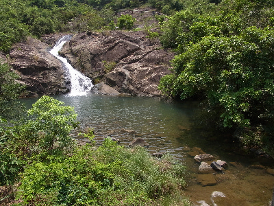
Most tributaries at upstream are steep and narrow. Strong down cutting creates various river landforms including V-shaped valleys, interlocking spurs, rapids and potholes. If the geology is suitable, waterfalls, plunge pools and gorges may form. Here, the downstream of Kam Tin River looks wide and flat. The major river landform of the lower course is meanders. However, due to river training works, most meanders are now fragmented.
Viewing from here, Kai Kung Leng is to your left while Tai Mo Shan is to your right. The flow runs from upstream of these mountains to downstream here.
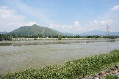
Kam Tin River Basin is bounded by hills including Kai Kung Leng (left) and Tai Mo Shan (right)
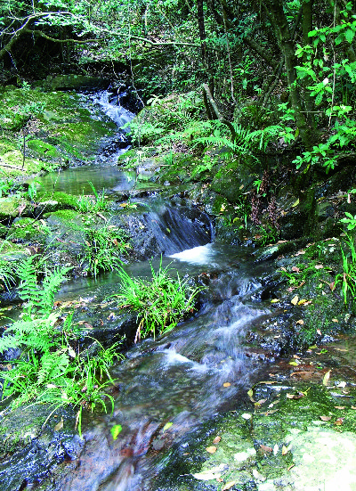
The upstream mostly comprises steep, shallow and narrow streams
The upper course of Kam Tin River at Ho Pui
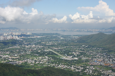
View of Kam Tin River Basin from Tai Mo Shan
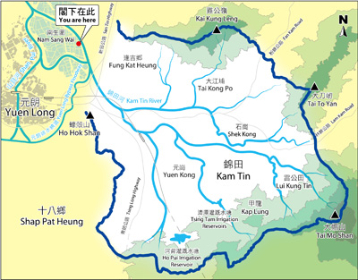
Map of the basin