
Project Objective
Project Objective: Improve Drainage Capacity
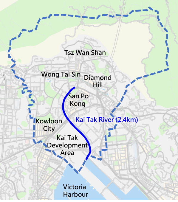
Existing Kai Tak River is about 2.4 km long. The river running along Choi Hung Road starts from Po Kong Village Road, through Tung Tau Estate, Prince Edward Road East, Kai Tak Development area and finally connects to Victoria Harbour. It is one of the major drainage channels in East Kowloon area. However, the drainage capacity of Kai Tak River was inadequate to meet the current flood protection standard. Severe flooding incidents have occurred at Choi Hung Road and affected Wong Tai Sin and San Po Kong area under heavy rainstorm. In order to improve the drainage capacity of Kai Tak River and mitigate flooding risk of surrounded area, the Drainage Services Department carried out improvements works for the Kai Tak River.
Review of Flooding Problem in Wong Tai Sin District
The following photos showing flooding incidents in Wong Tai Sin District were taken in 2008, 2010, 2014 and 2015.
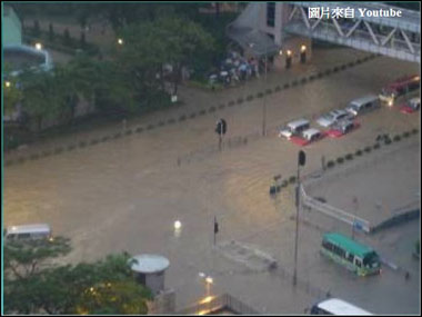
Black rainstorm on 7 June 2008
Max. rainfall : 145.5 mm/hr
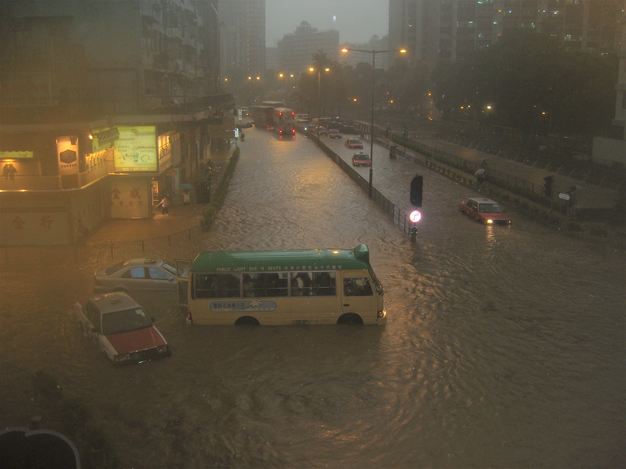
Black rainstorm on 22 July 2010
Max. rainfall : 93.1 mm/hr
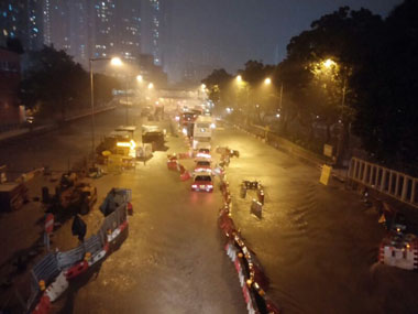
Black rainstorm on 30 March 2014
Max. rainfall : 104 mm/hr
Black rainstorm on 8 May 2014
Max. rainfall : 85 mm/hr
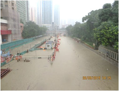
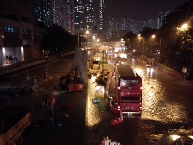
Amber rainstorm on 26 Sept 2015
Max. rainfall : 103 mm/hr
Public Engagement
Government proposed to carry out drainage improvement works in Kai Tak River, discussed with Wong Tai Sin District Council and thereafter launched public engagement activities “Jointly Build Kai Tak River” in 2010 and 2011. Three design principles were concluded:
- Accord high priority to increase drainage capacity
- Revitalise Kai Tak River as urban green river corridor
- Minimise river decking
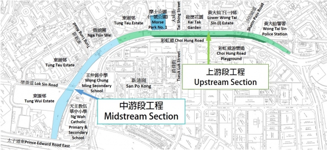
Two Strategies
The Drainage Services Department is responsible for a total of 1.1 km for the Kai Tak River Improvement Works in Wong Tai Sin District and adopts two flood prevention strategies.
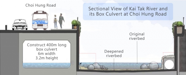
Sectional View of Kai Tak River and its Box Culvert at Choi Hung Road

Overview Strategies Map
Three Major Challenges
The Drainage Services Department encountered 3 major construction challenges when carrying out the works:
Relocate substantial amount of public utilities in river
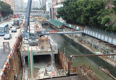
Maintain flow of Kai Tak River
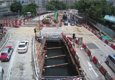
Implement large-scale temporary traffic arrangement
Four Revitalisation Elements
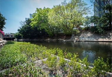
The drainage capacity of Kai Tak River can reach the current design standard, so as to mitigate the flooding risk in nearby areas. The Drainage Services Department is also taking this opportunity to inject various greening and ecological elements into Kai Tak River, thus revitalizing it into an “urban green river corridor”.
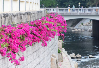
Roadside planters
Draping plant Bougainvillea spectabilis is planted in roadside planters along the river. It usually blossoms twice a year. Its vivid flowers can revitalise the riverbank.
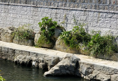
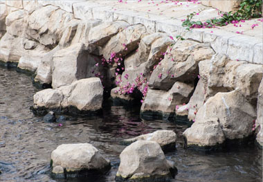
Artificial rock planters
To simulate the ‘natural bedrock’ in Kai Tak river, artificial rock is adopted and hidden soil pockets are introduced to artificial rock to support plant growth.
Submerged planters
Submerged plants are planted in wider section of the river.
Fish shelters and flow deflectors
Fish shelters and flow deflectors were added in the river to induce variations in river flow direction and velocity for fishes.
Project Details
| Upstream Section | Midstream Section | |
|---|---|---|
| Contract | Reconstruction, Improvement and Rehabilitation of Kai Tak River from Wong Tai Sin Police Station to Tung Tau II Estate | Reconstruction and Rehabilitation of Kai Tak River from Tung Kwong Road to Prince Edward Road East |
| Contract No. | DC/2011/04 | DC/2013/03 |
| Project Scope |
|
|
| Commencement Date | October 2011 | December 2013 |
| Completion Date | June 2018 | November 2017 |
| Consultant | AECOM Consulting Services Limited | Atkins China Limited |
| Contractors | Leader- Sunnic Joint Venture | China Road and Bridge Corporation |
| Project Estimate | About HK$1.6 billion | About HK$1.2 billion |