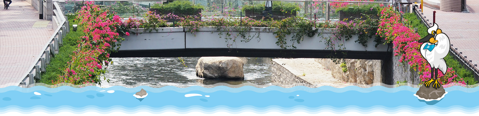
Kai Tak River Trail
Kai Tak River Trail
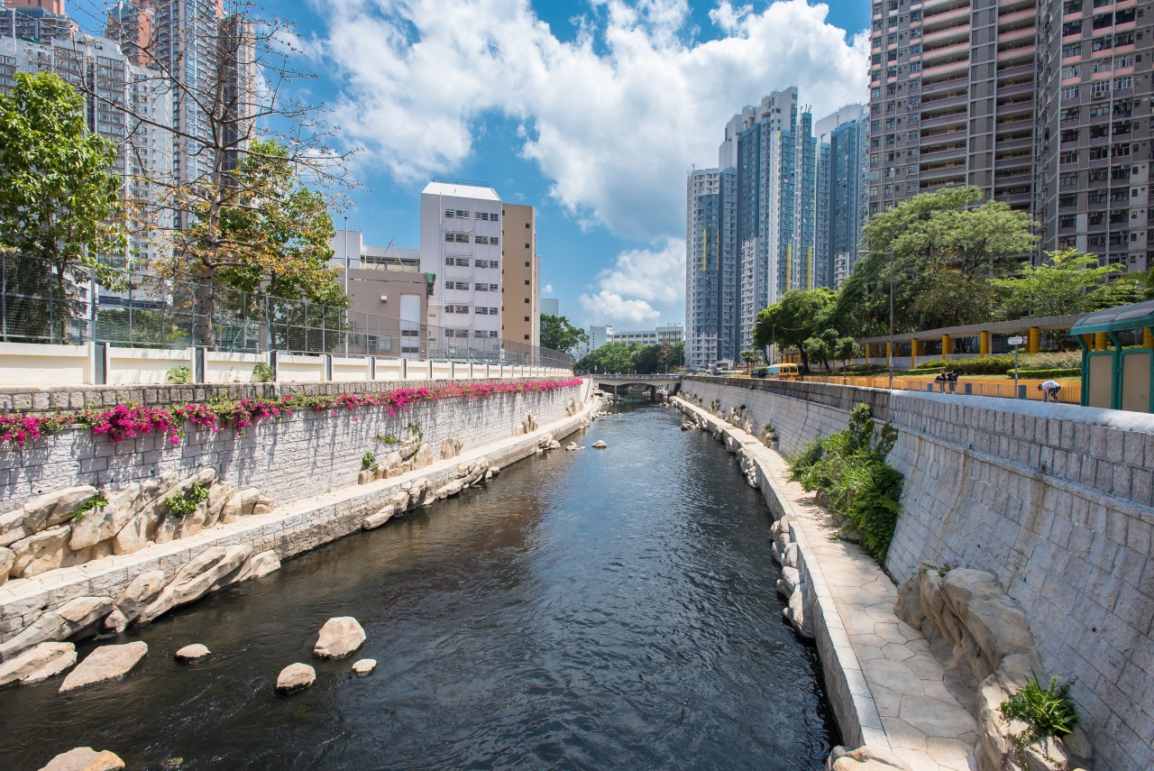
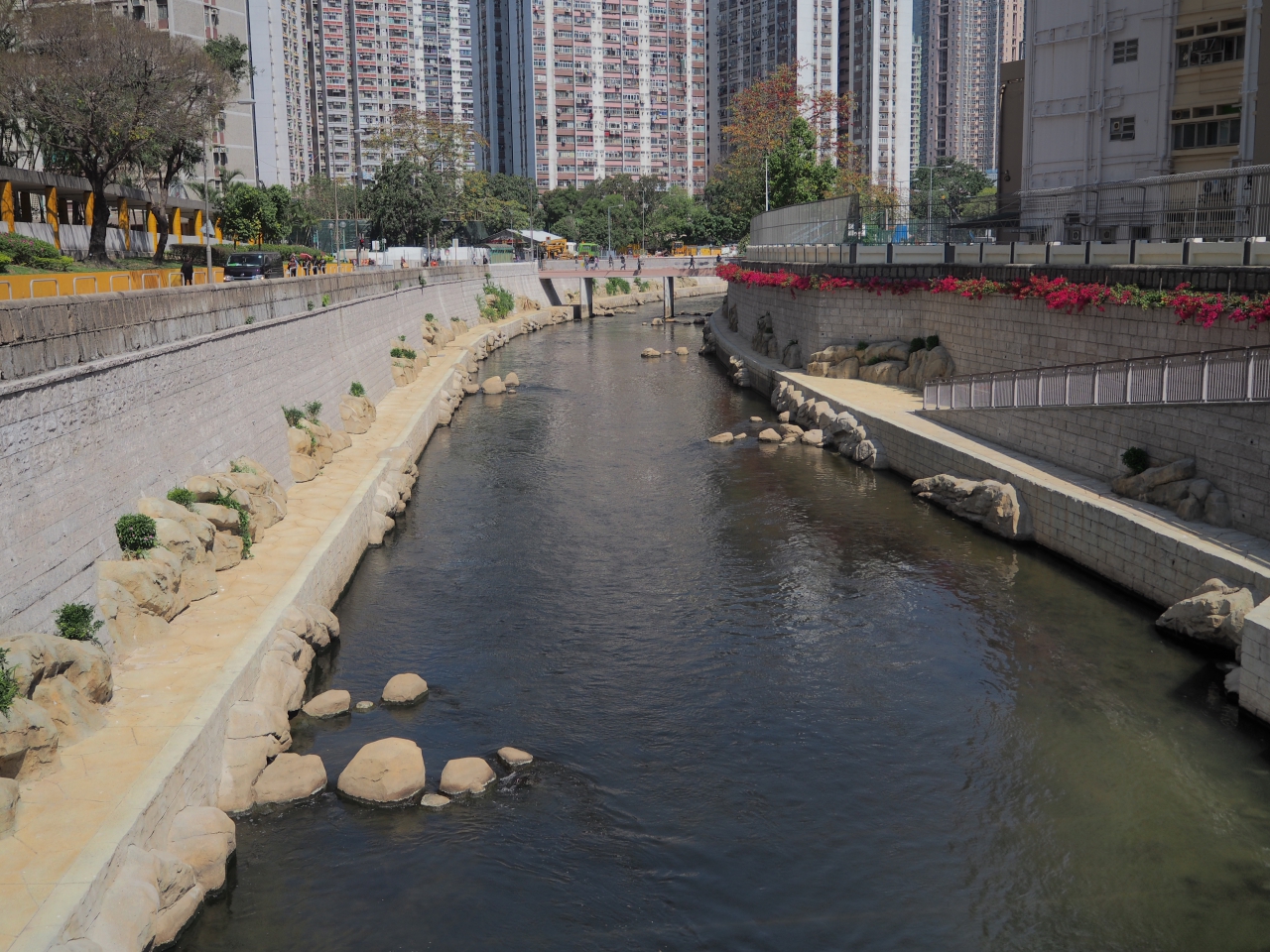
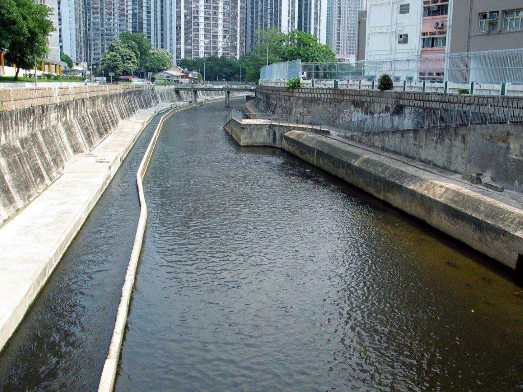
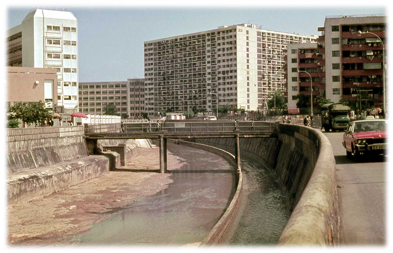
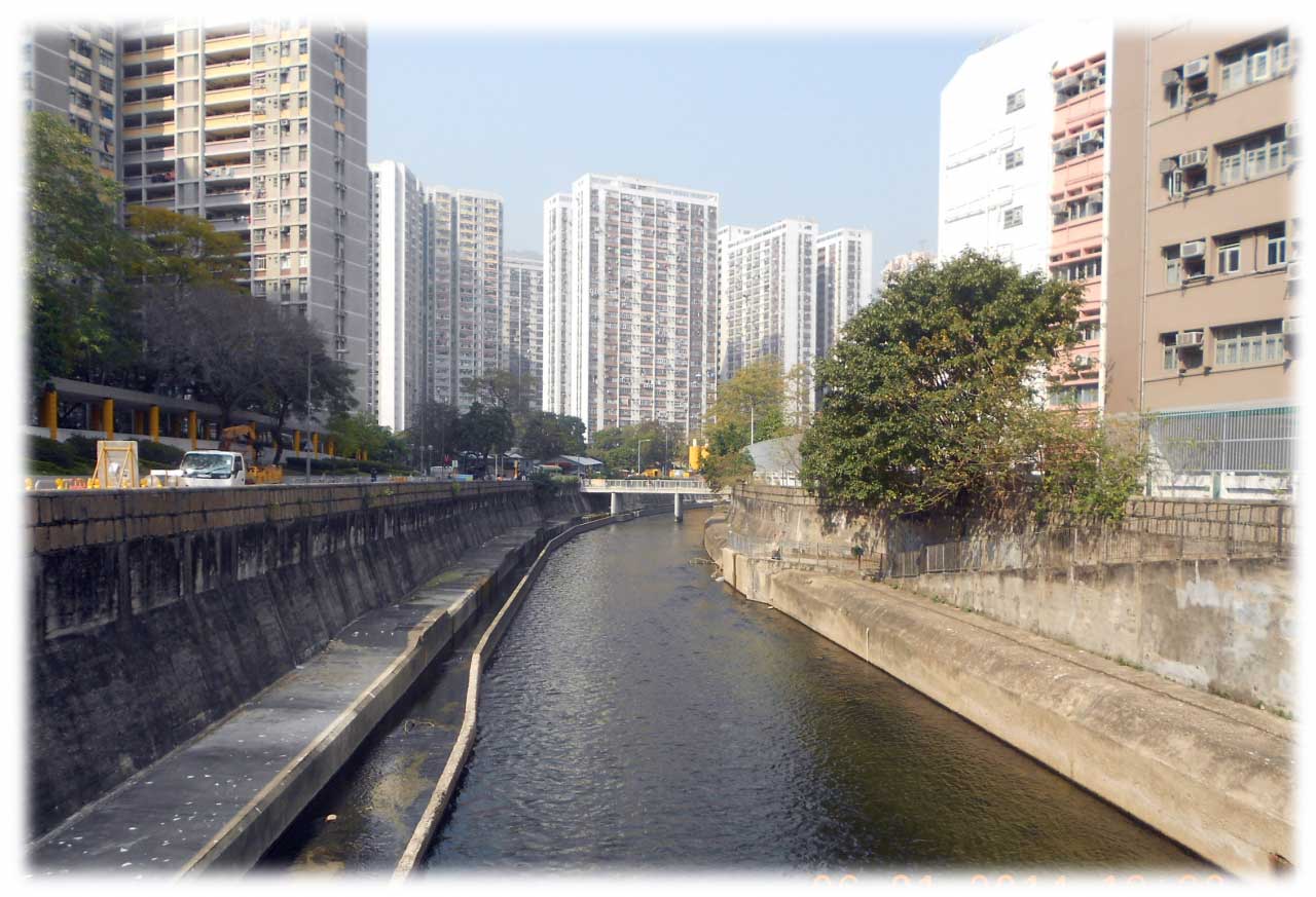
Kai Tak River after revitalisation
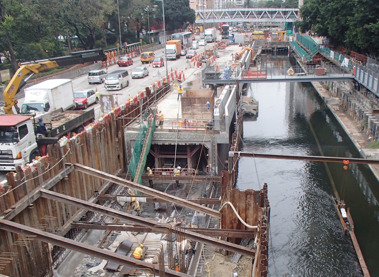
Known as Kai Tak Nullah in the past, the approximate 2.4 kilometres Kai Tak River is one of East Kowloon’s major drainage channels. Due to urban developments and extreme weather conditions, serious flooding occurred in Choi Hung Road during rainstorms, affecting nearby residents. As the nullah did not meet the current flood prevention standards, the Drainage Services Department (DSD) implemented river improvement works in stages to improve the 1.1 kilometres section of the nullah in Wong Tai Sin, in order to improve the drainage capacity of Kai Tak River and mitigate flooding risk of surrounded area. Construction works commenced in stages from October 2011 and were completed in 2018.
DSD also seized the opportunity to improve the scenery of the local urban setting and provide leisure place for the public to enhance overall living environment of the area. To this end, greening and ecological elements were included in the Kai Tak River Improvement Works to revitalise this water body into an urban green river corridor that links the river closely with the local neighbourhood.
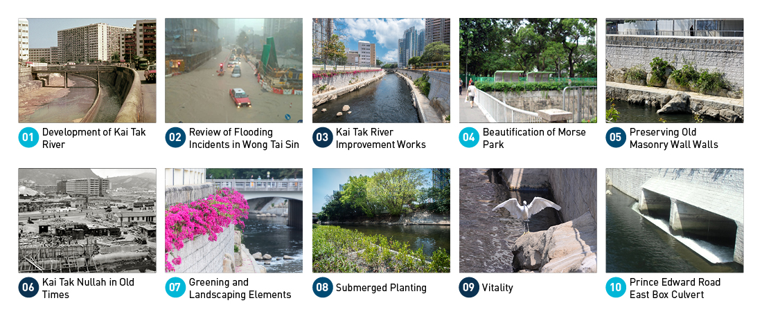
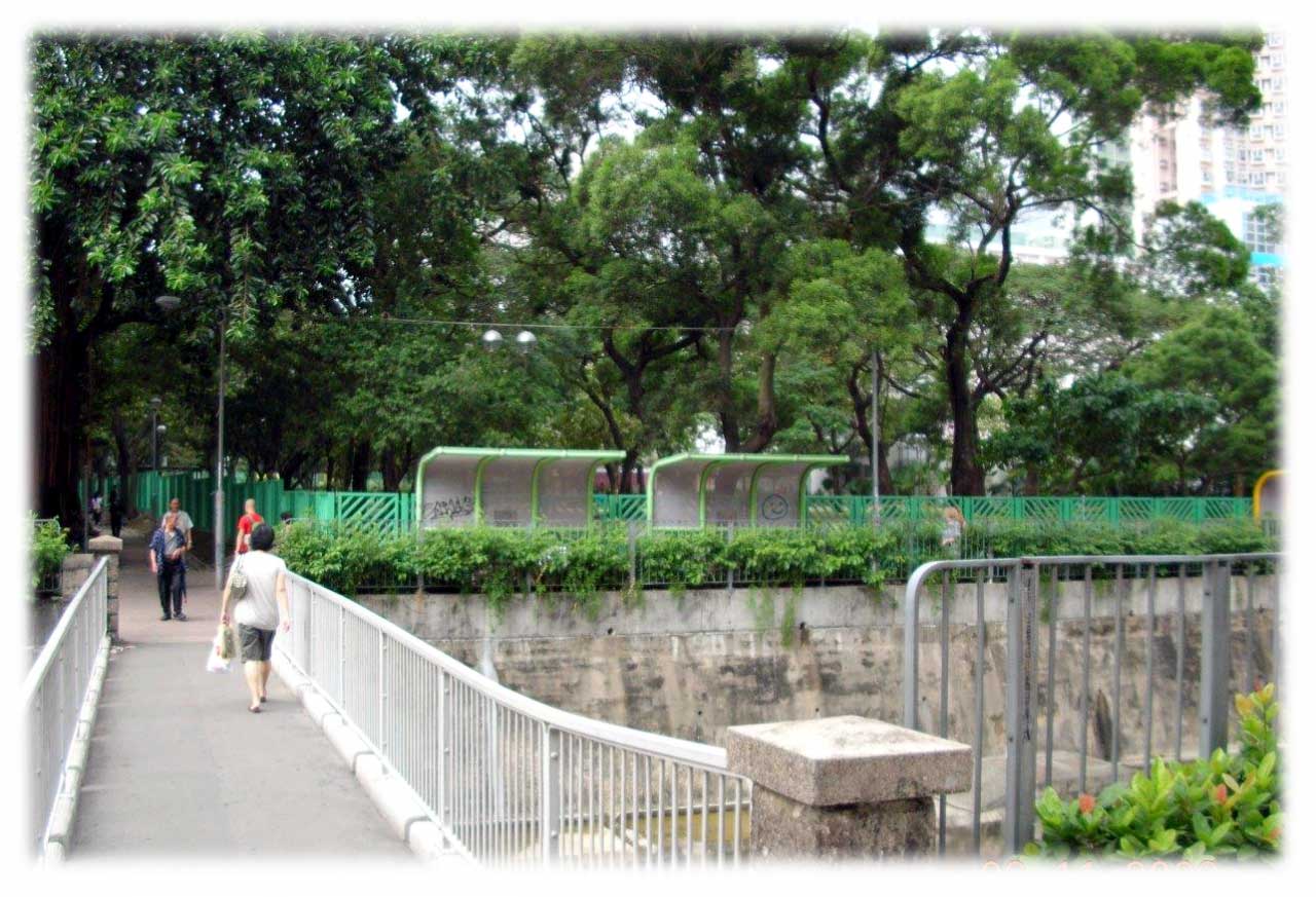
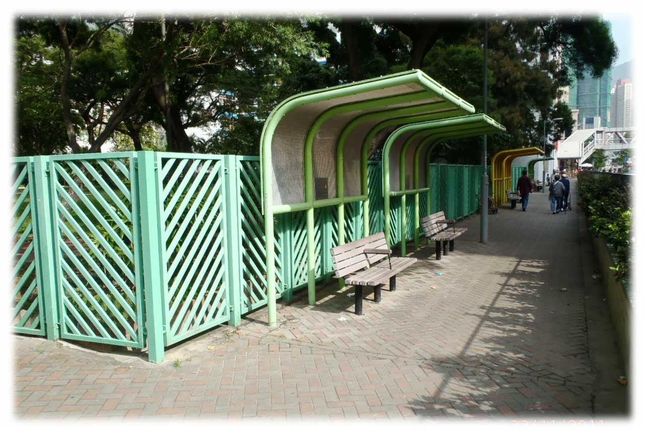
DSD set up a trail along Kai Tak River in Wong Tai Sin district. It starts at Shatin Pass Road and ends at Prince Edward Road East with 10 panels in different locations along the 1 kilometre riverbank of Kai Tak River. History of Kai Tak River and information of the drainage improvement works are introduced to the public.
Kai Tak River after revitalisation
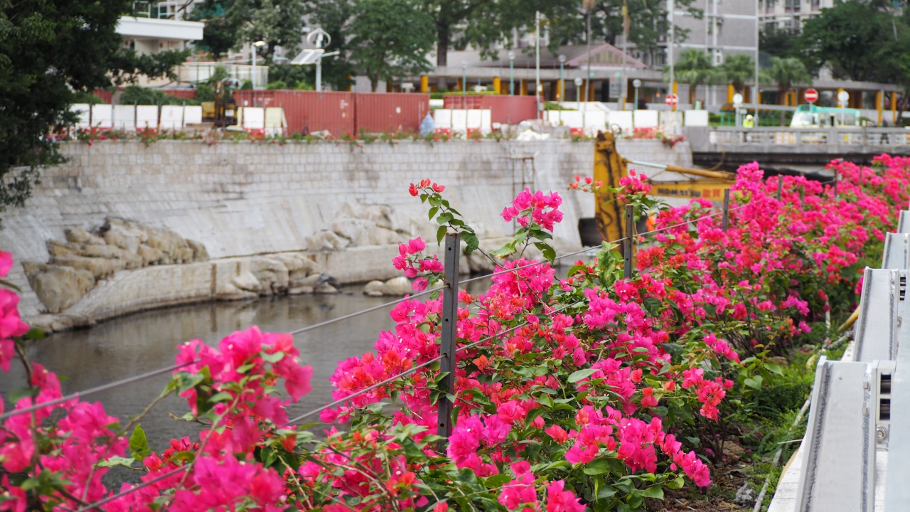
Draping plants Bougainvillea spectabilis
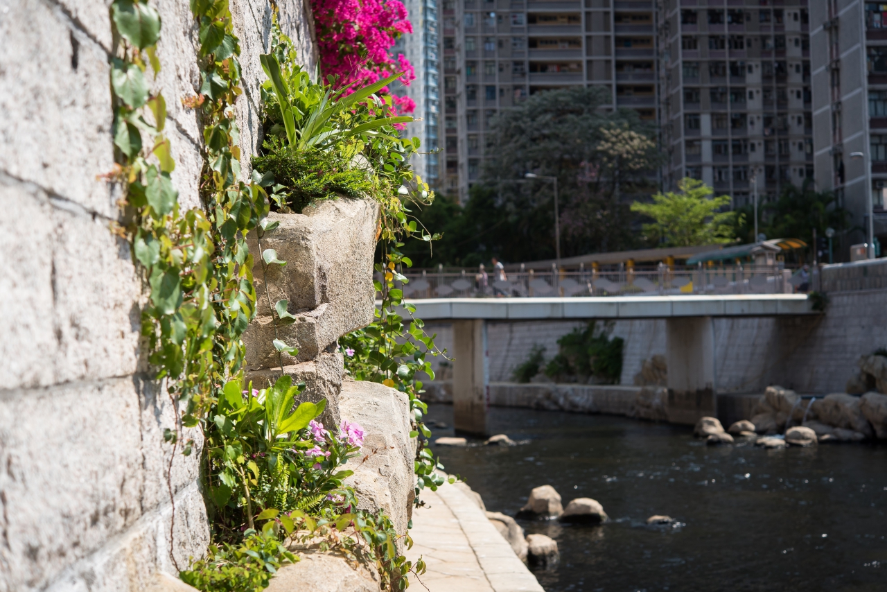
Artificial rock planters
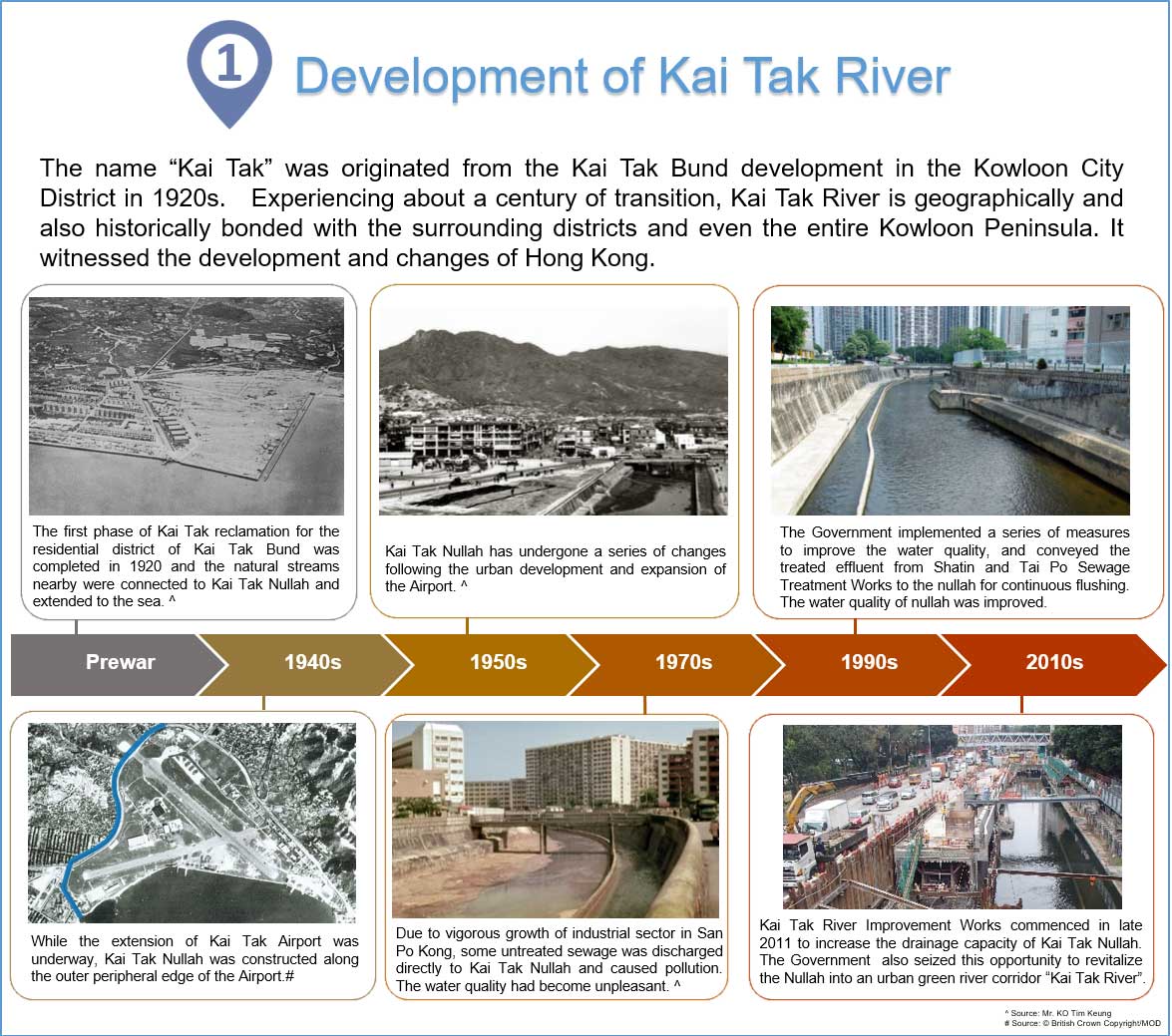
Development of Kai Tak River
The name “Kai Tak” was originated from the Kai Tak Bund development in the Kowloon City District in 1920s. Experiencing about a century of transition, Kai Tak River is geographically and also historically bonded with the surrounding districts and even the entire Kowloon Peninsula. It witnessed the development and changes of Hong Kong.
In the prewar era, the first phase of Kai Tak reclamation for the residential district of Kai Tak Bund was completed in 1920 and the natural streams nearby were connected to Kai Tak Nullah and extended to the sea. (Source: Mr. KO Tim Keung)
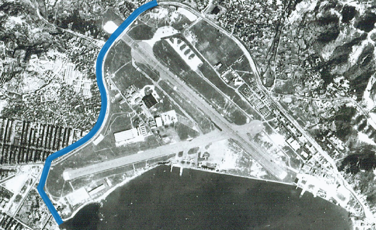
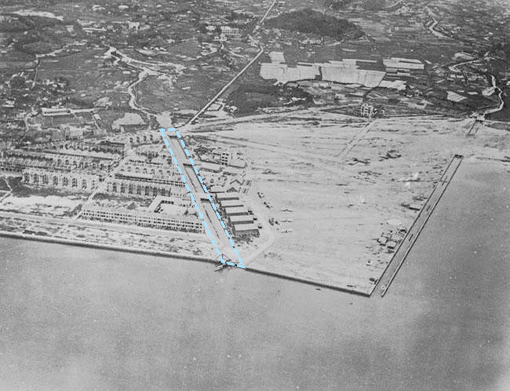
In 1940s, while the extension of Kai Tak Airport was underway, Kai Tak Nullah was constructed along the outer peripheral edge of the Airport. (Source: © British Crown Copyright/MOD)
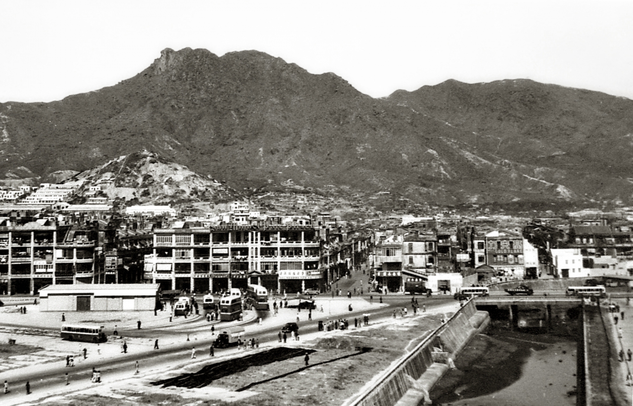
In 1950s, Kai Tak Nullah has undergone a series of changes following the urban development and expansion of the Airport. (Source: Mr. KO Tim Keung)
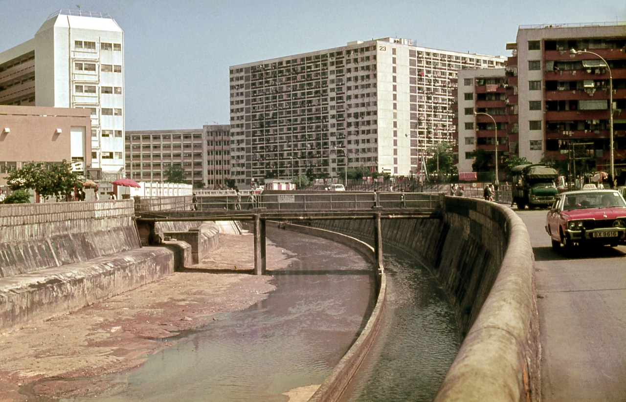
In 1970s, due to vigorous growth of industrial sector in San Po Kong, some untreated sewage was discharged directly to Kai Tak Nullah and caused pollution. The water quality had become unpleasant. (Source: Mr. KO Tim Keung)
In 1990s, the Government implemented a series of measures to improve the water quality, and conveyed the treated effluent from Sha Tin and Tai Po Sewage Treatment Works to the nullah for continuous flushing. The water quality of nullah was improved. (Source: Mr. KO Tim Keung)
In 2010s, Kai Tak River Improvement Works commenced in late 2011 to increase the drainage capacity of Kai Tak Nullah. The Government also seized this opportunity to revitalize the Nullah into an urban green river corridor “Kai Tak River”.
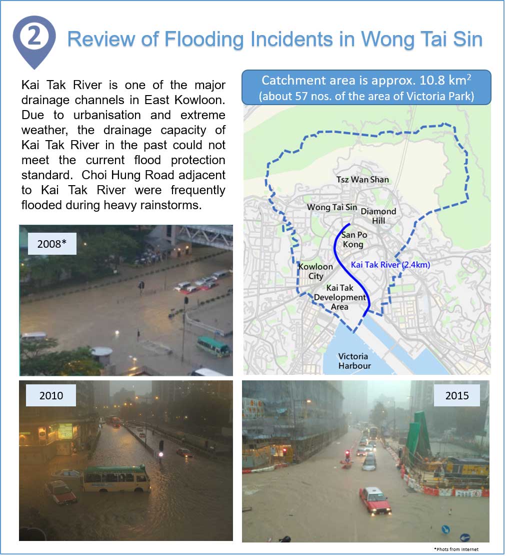
Review of Flooding Incidents in Wong Tai Sin
Kai Tak River is one of the major drainage channels in East Kowloon. Due to urbanisation and extreme weather, the drainage capacity of Kai Tak River in the past could not meet the current flood protection standard. Choi Hung Road adjacent to Kai Tak River were frequently flooded during heavy rainstorms.
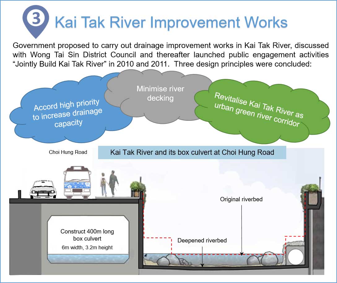
Kai Tak River Improvement Works
Government proposed to carry out drainage improvement works in Kai Tak River, discussed with Wong Tai Sin District Council and thereafter launched public engagement activities “Jointly Build Kai Tak River” in 2010 and 2011. Three design principles were concluded:
- Accord high priority to increase drainage capacity
- Minimise river decking
- Revitalise Kai Tak River as urban green river corridor
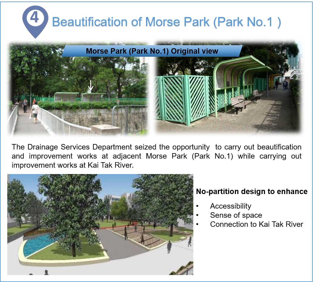
Beautification of Morse Park (Park No.1)
The Drainage Services Department seized the opportunity to carry out beautification and improvement works at adjacent Morse Park (Park No.1) while carrying out improvement works at Kai Tak River.
No-partition design to enhance
- Accessibility
- Sense of space
- Connection to Kai Tak River
Morse Park (Park No.1) Original View
Morse Park (Park No.1) Original View
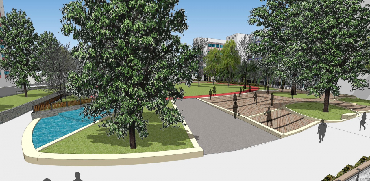
Photomontage of Beautified Morse Park (Park No.1)
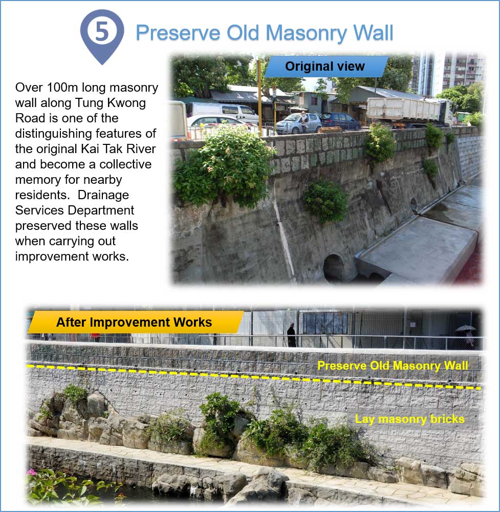
Preserve Old Masonry Wall
Over 100m long masonry wall along Tung Kwong Road is one of the distinguishing features of the original Kai Tak River and become a collective memory for nearby residents. Drainage Services Department preserved these walls when carrying out improvement works.
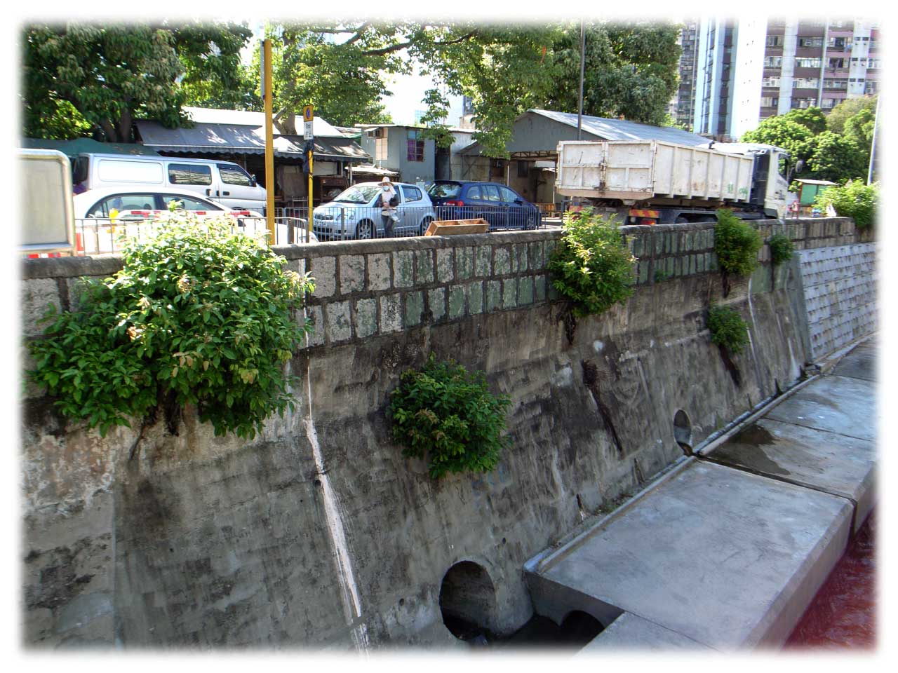
Original View of Old Masonry Wall
Preserving Old Masonry Wall Walls
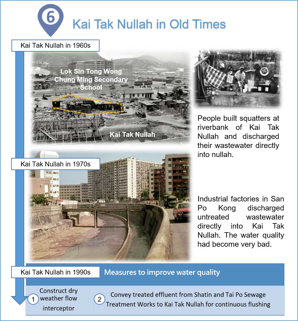
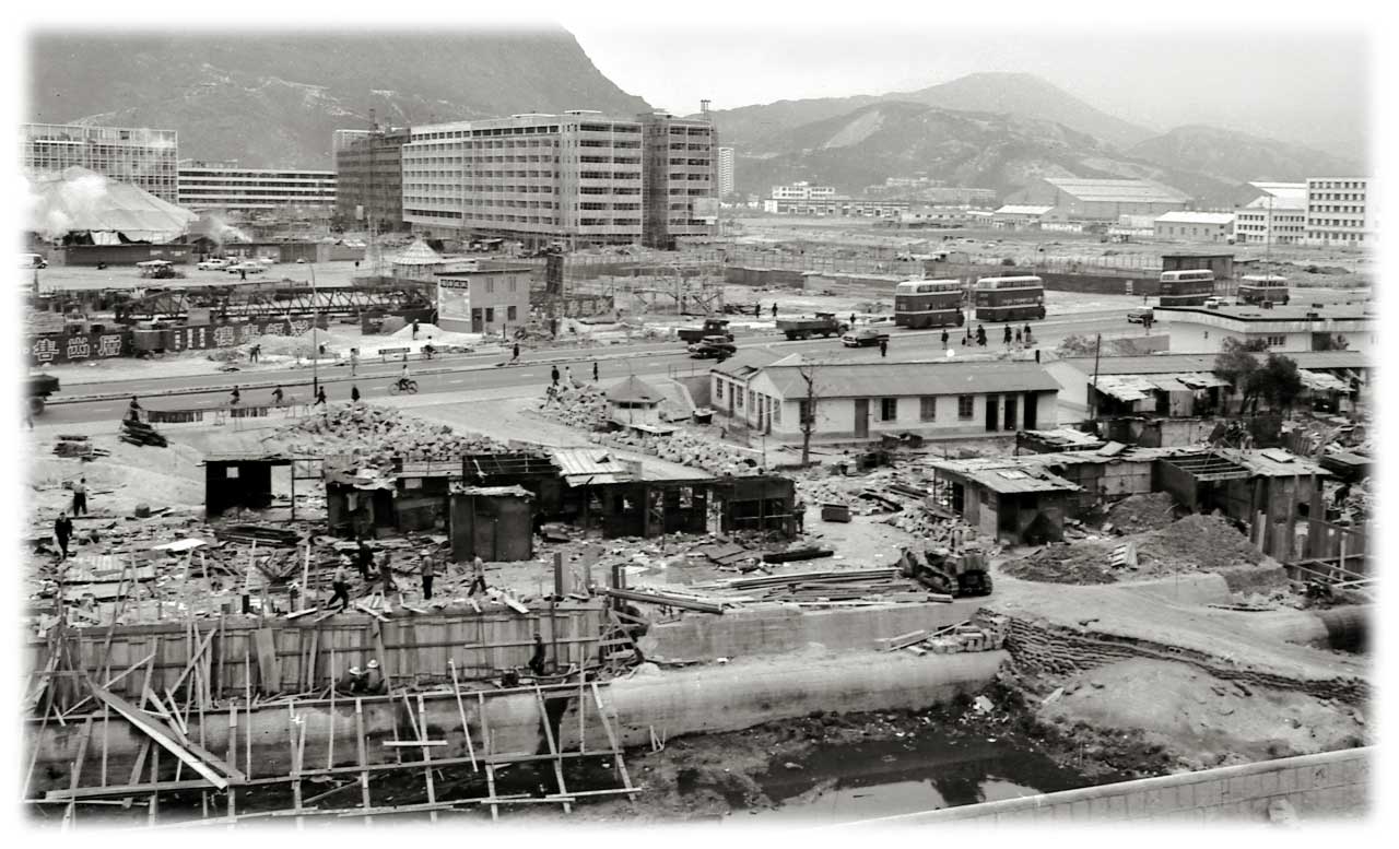
Kai Tak Nullah in Old Times
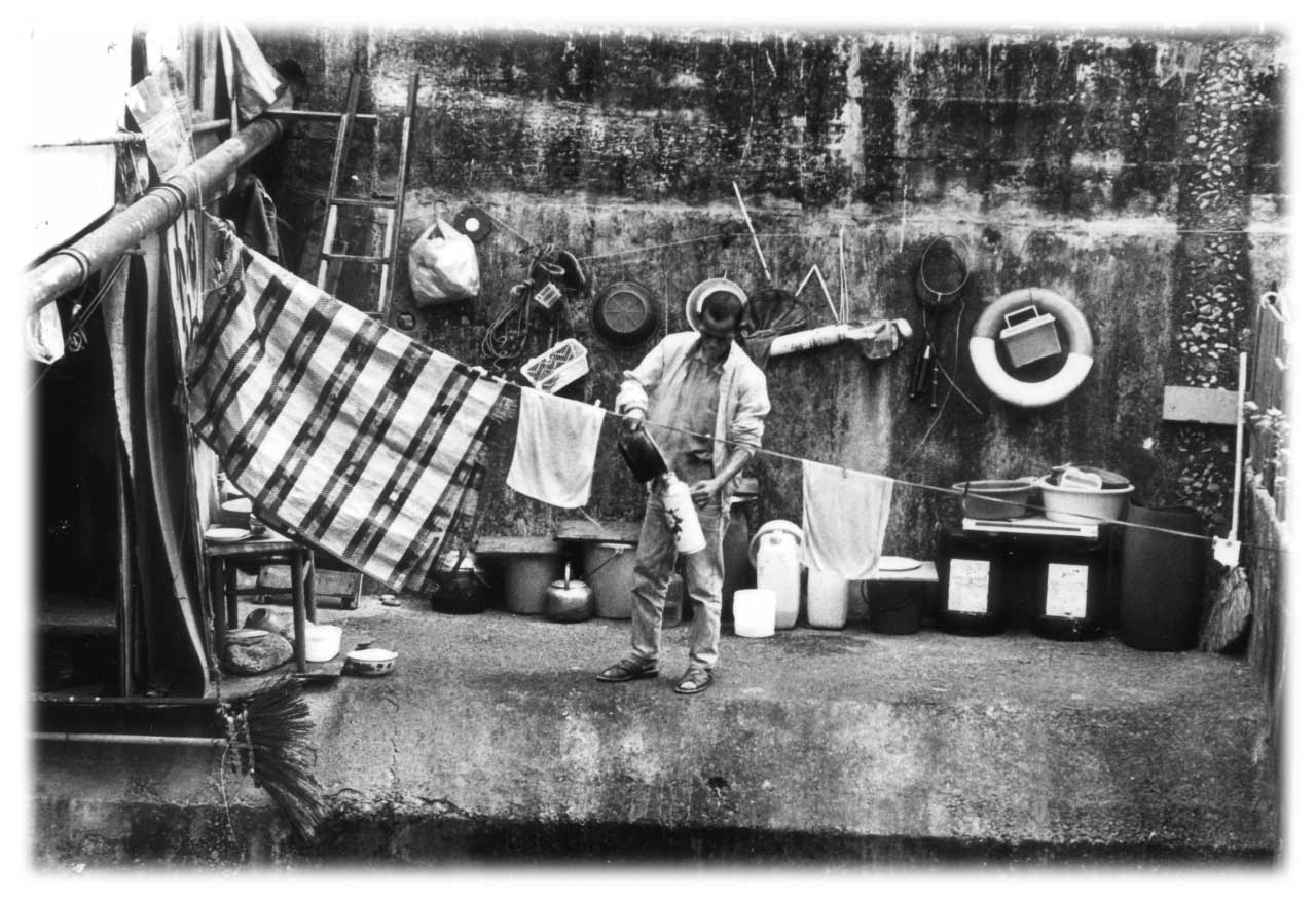
In 1960s, people built squatters at riverbank of Kai Tak Nullah and discharged their wastewater directly into nullah.
In 1970s, industrial factories in San Po Kong discharged untreated wastewater directly into Kai Tak Nullah. The water quality had become very bad.
In 1990s, two measures were implemented to improve the water quality of Kai Tak Nullah:
- Constructing dry weather flow interceptor
- Conveying treated effluent from Shatin and Tai Po Sewage Treatment Works to Kai Tak Nullah for continuous flushing
Kai Tak Nullah in 1960s
Kai Tak Nullah in 1960s
Kai Tak Nullah in 1970s
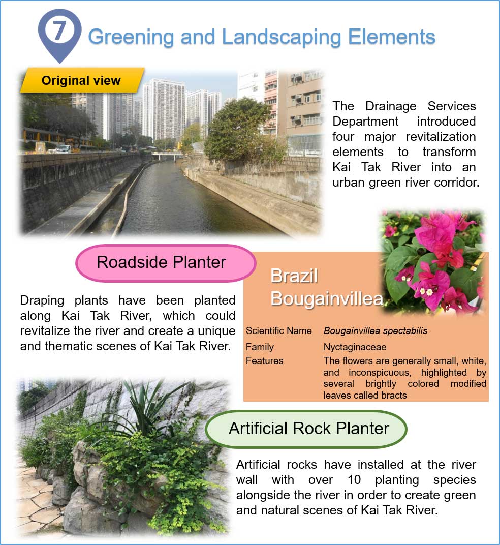
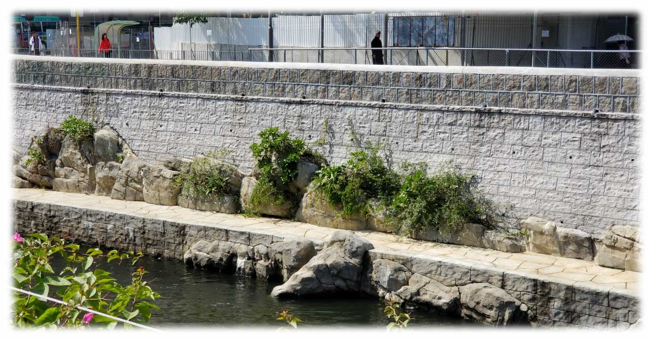
Greening and Landscaping Elements
The Drainage Services Department introduced four major revitalization elements to transform Kai Tak River into an urban green river corridor.
Roadside Planter
Draping plants have been planted along Kai Tak River, which could revitalize the river and create a unique and thematic scenes of Kai Tak River.
Artificial Rock Planter
Artificial rocks have installed at the river wall with over 10 planting species alongside the river in order to create green and natural scenes of Kai Tak River.
Original View of Kai Tak River
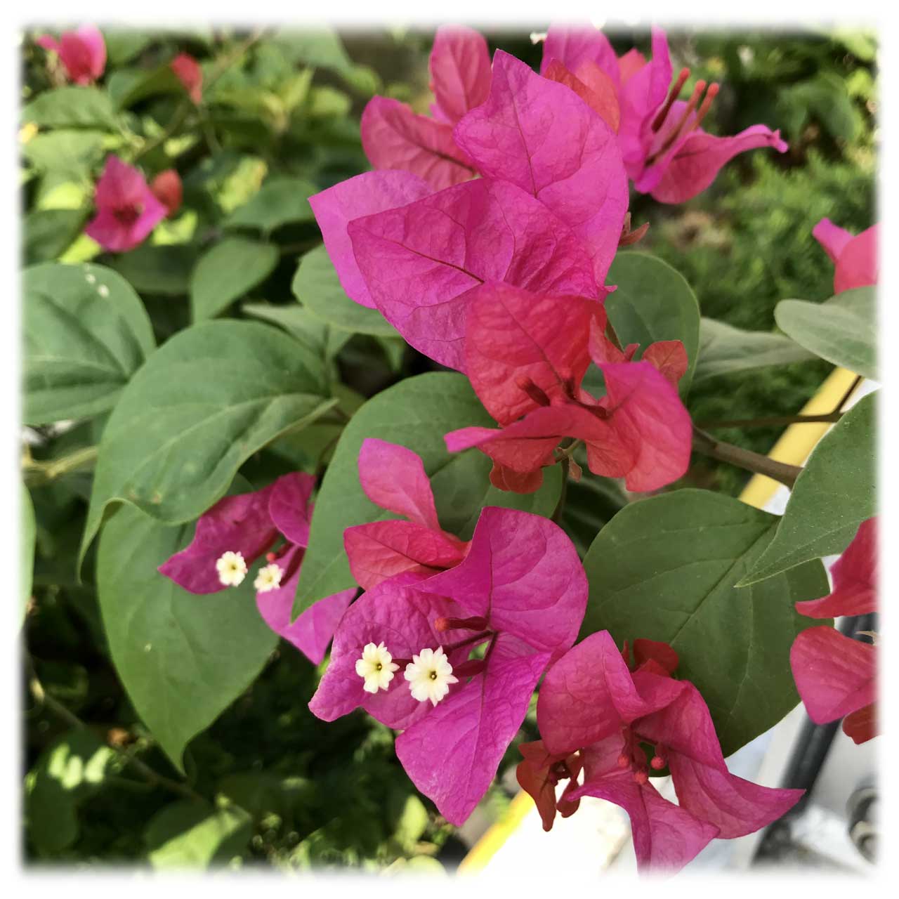
Roadside Planter - Brazil Bougainvillea
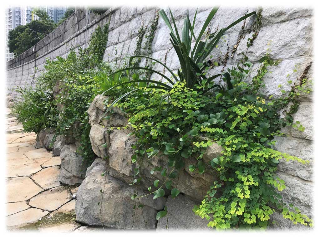
Artificial Rock Planter
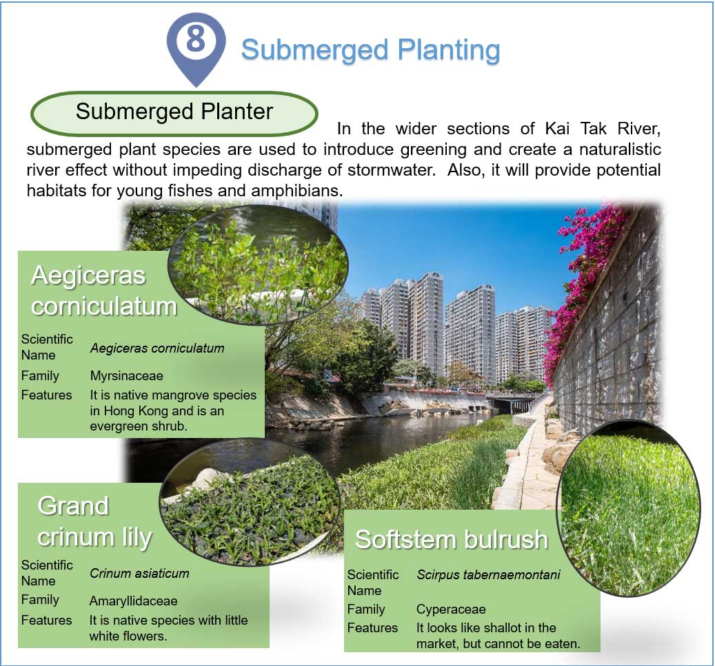
Submerged Planting
In the wider sections of Kai Tak River, submerged plant species are used to introduce greening and create a naturalistic river effect without impeding discharge of stormwater. Also, it will provide potential habitats for young fishes and amphibians.
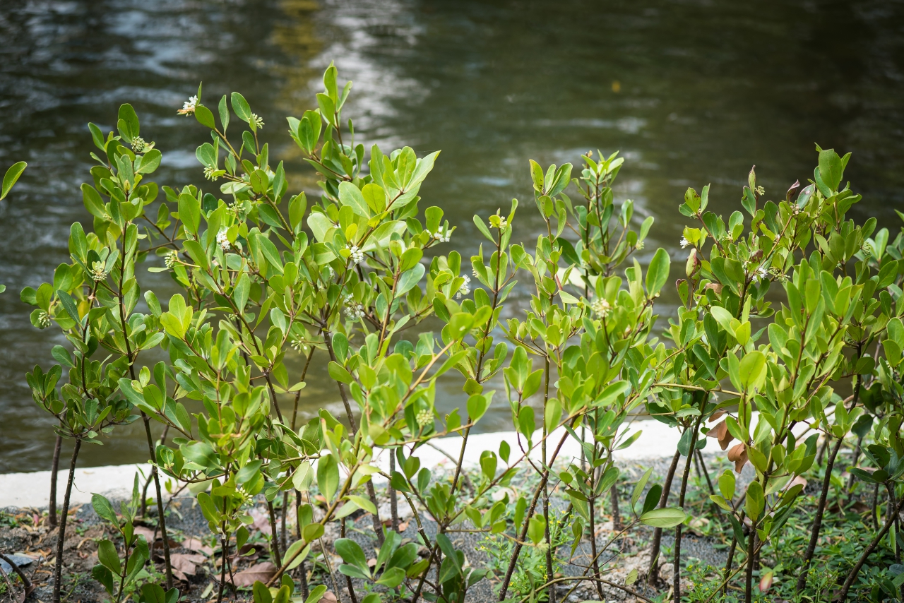
Aegiceras Corniculatum
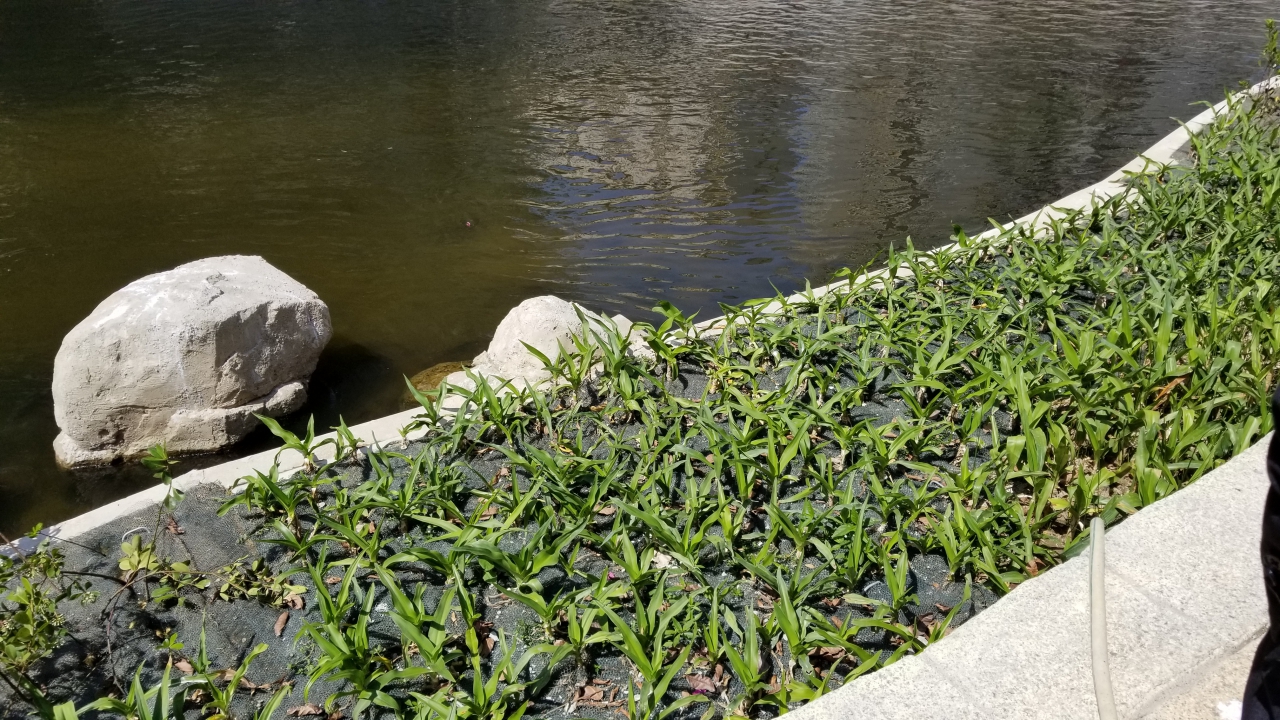
Grand Crinum Lily
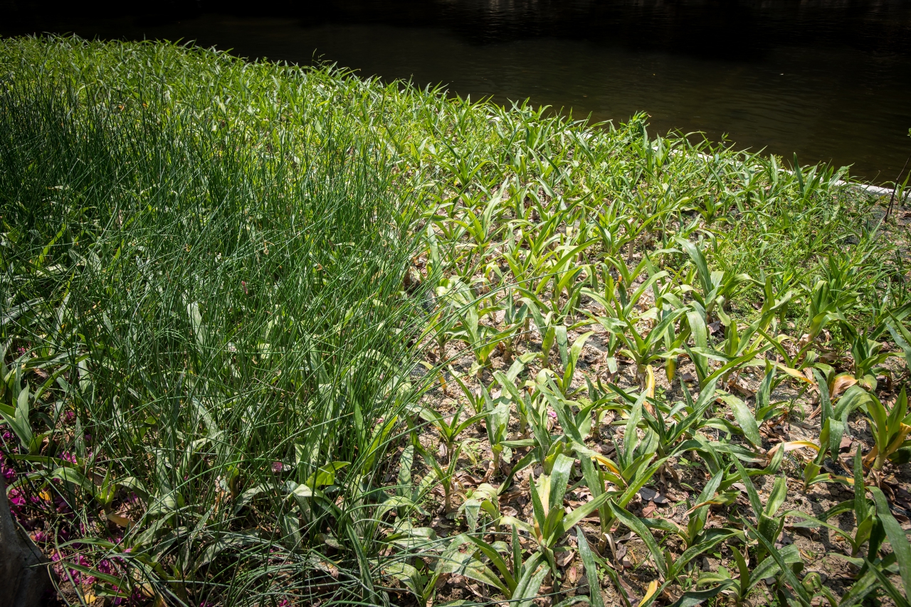
Softstem Bulrush
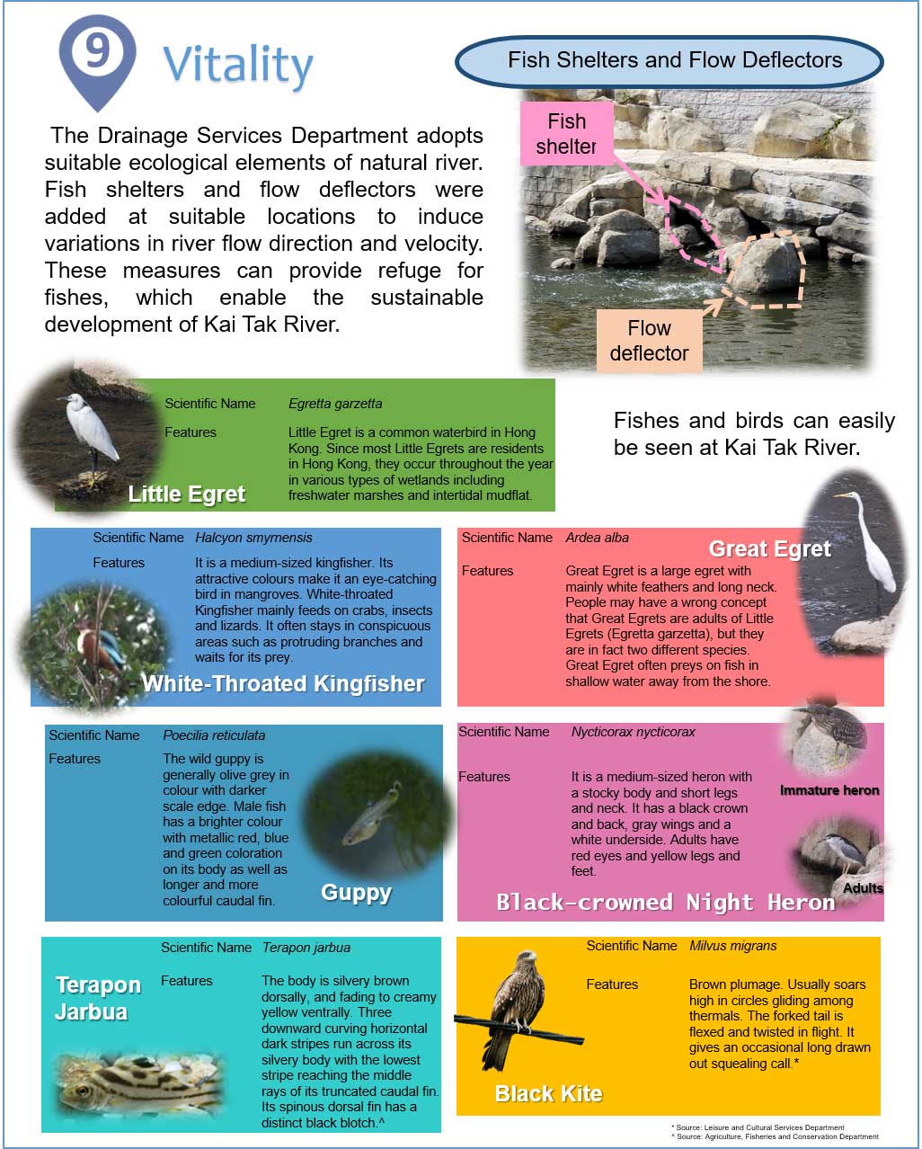
Vitality
The Drainage Services Department adopts suitable ecological elements of natural river. Fish shelters and flow deflectors were added at suitable locations to induce variations in river flow direction and velocity. These measures can provide refuge for fishes, which enable the sustainable development of Kai Tak River.
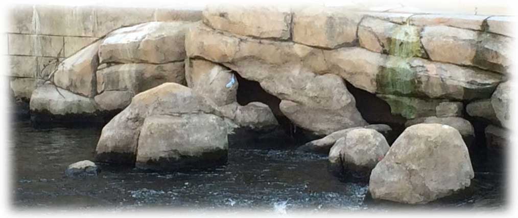
Fish Shelters and Flow Deflectors
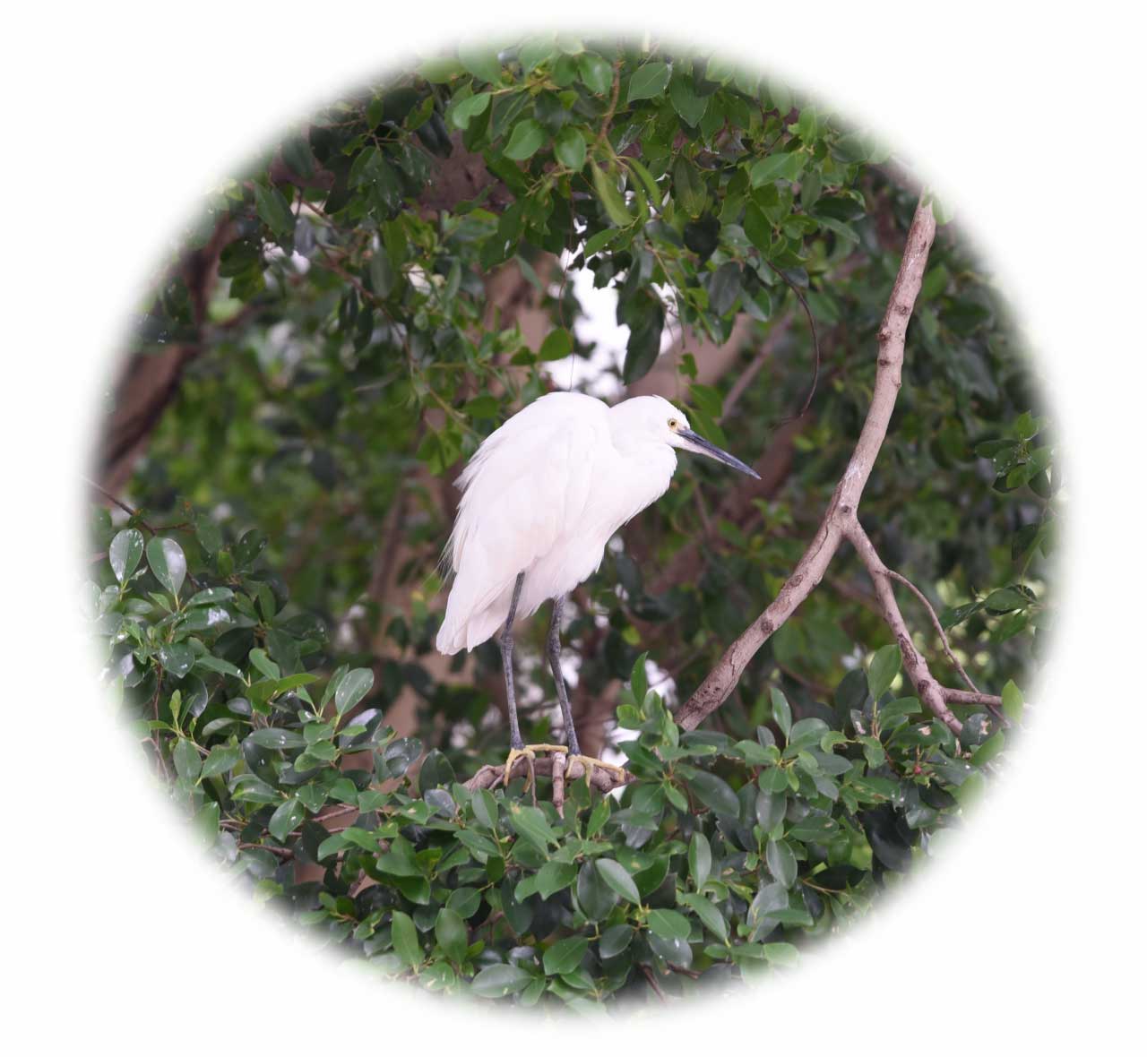
Little Egret
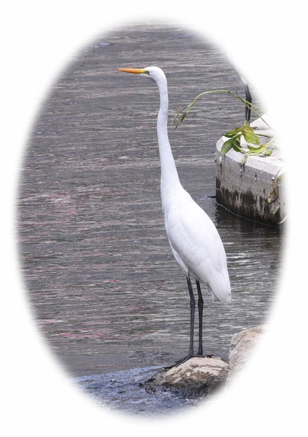
Great Egret
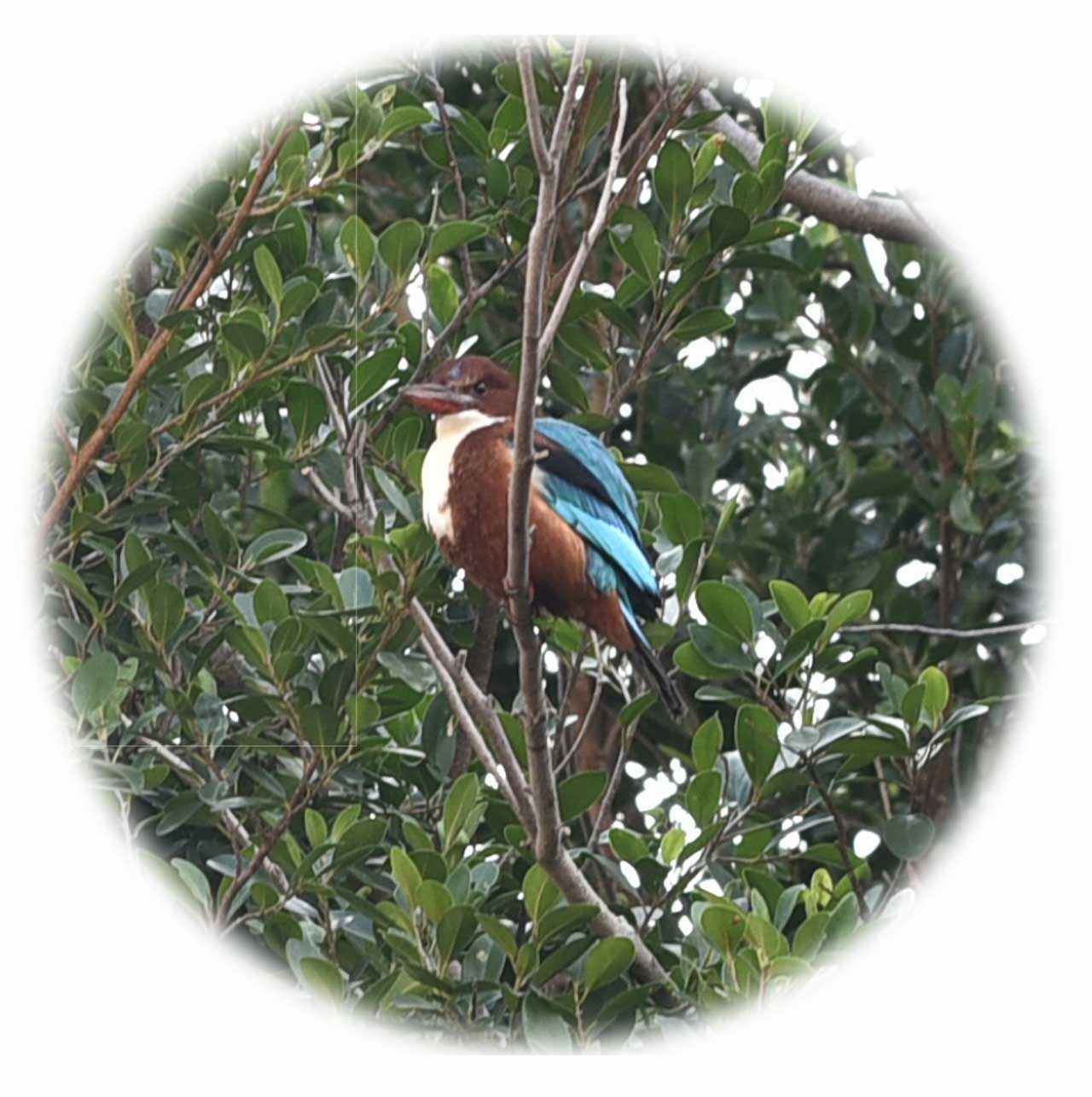
White-Throated Kingfisher
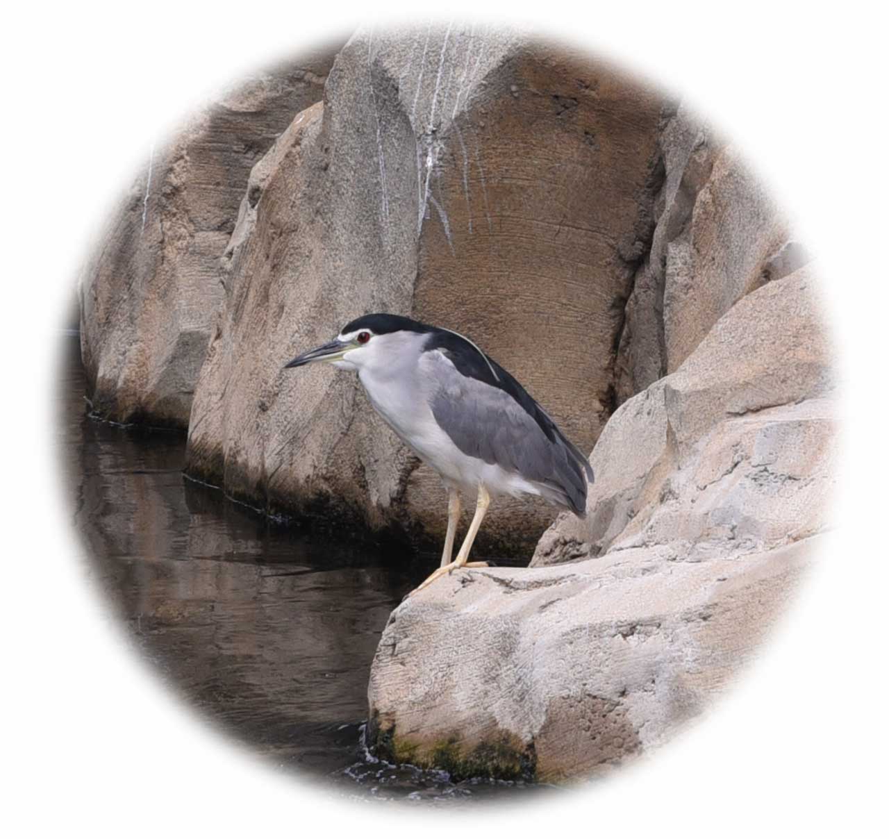
Black-crowned Night Heron (Adults)
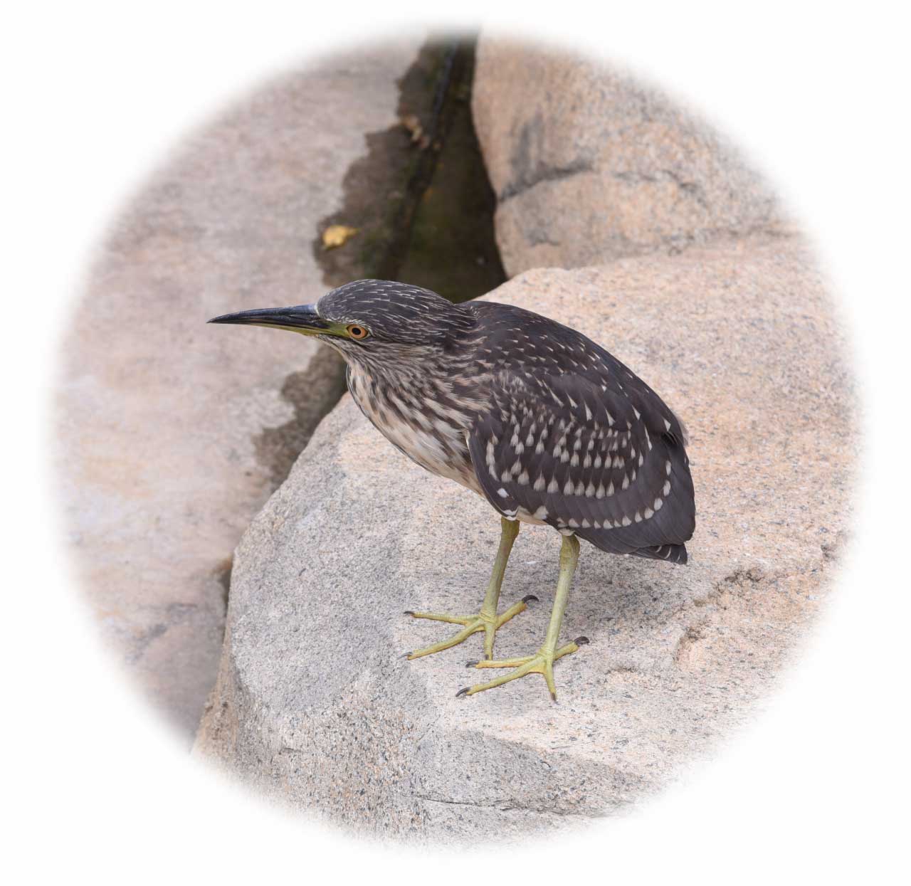
Black-crowned Night Heron (Immature Heron)
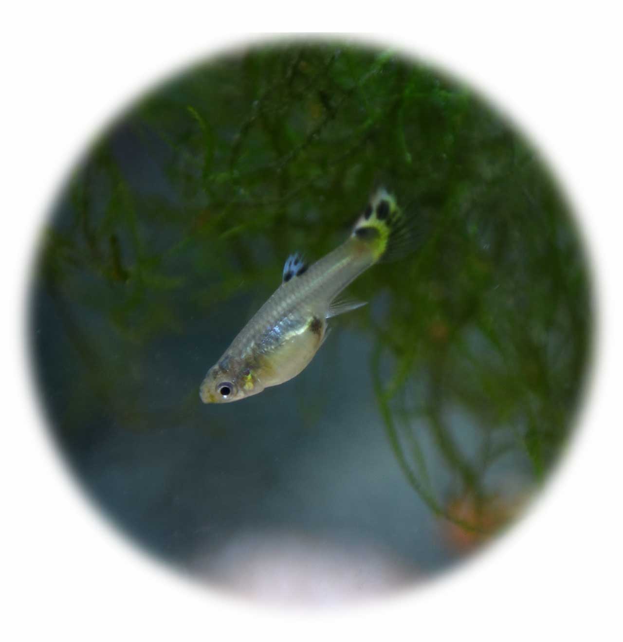
Guppy
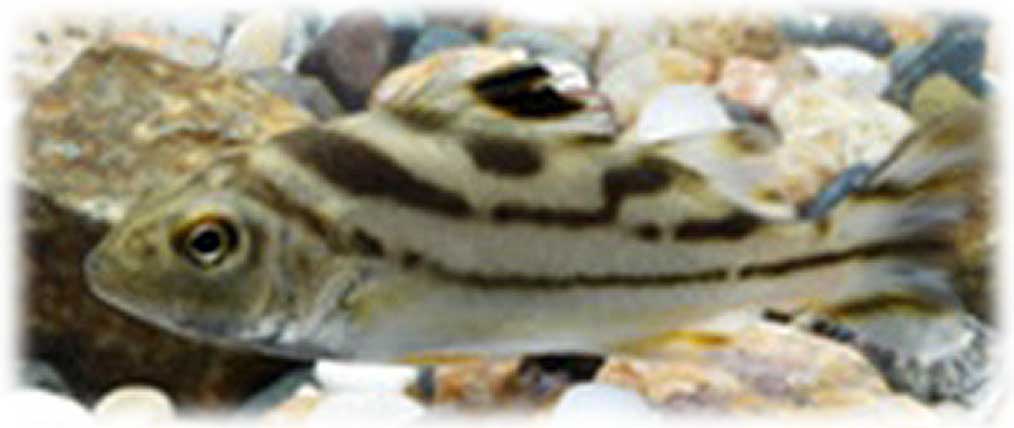
Terapon Jarbua
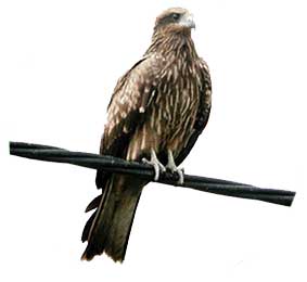
Black Kite
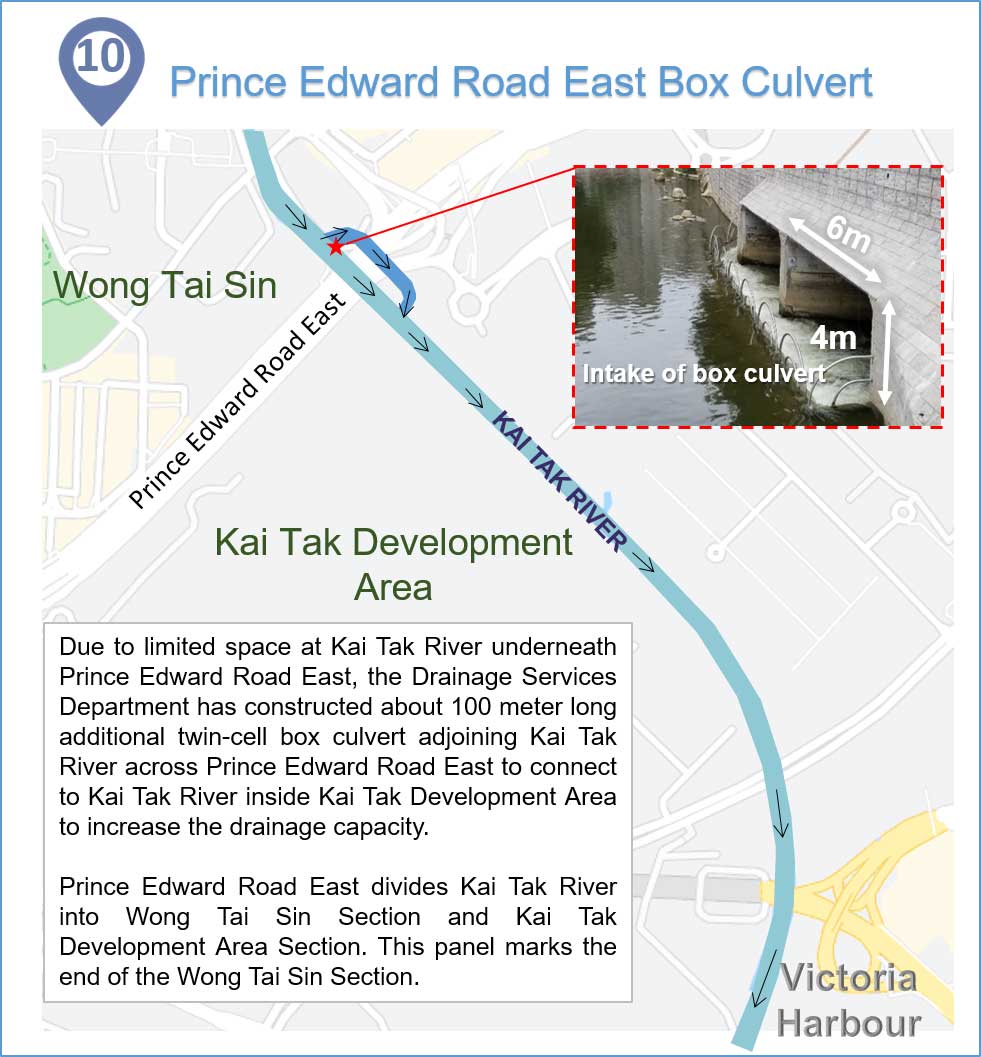
Prince Edward Road East Box Culvert
Due to limited space at Kai Tak River underneath Prince Edward Road East, the Drainage Services Department has constructed about 100 metres long additional twin-cell box culvert adjoining Kai Tak River across Prince Edward Road East to connect to Kai Tak River inside Kai Tak Development Area to increase the drainage capacity.
Prince Edward Road East divides Kai Tak River into Wong Tai Sin Section and Kai Tak Development Area Section. This panel marks the end of the Wong Tai Sin Section.
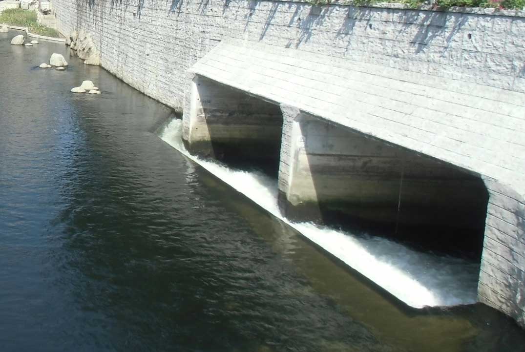
Intake of Box Culvert