
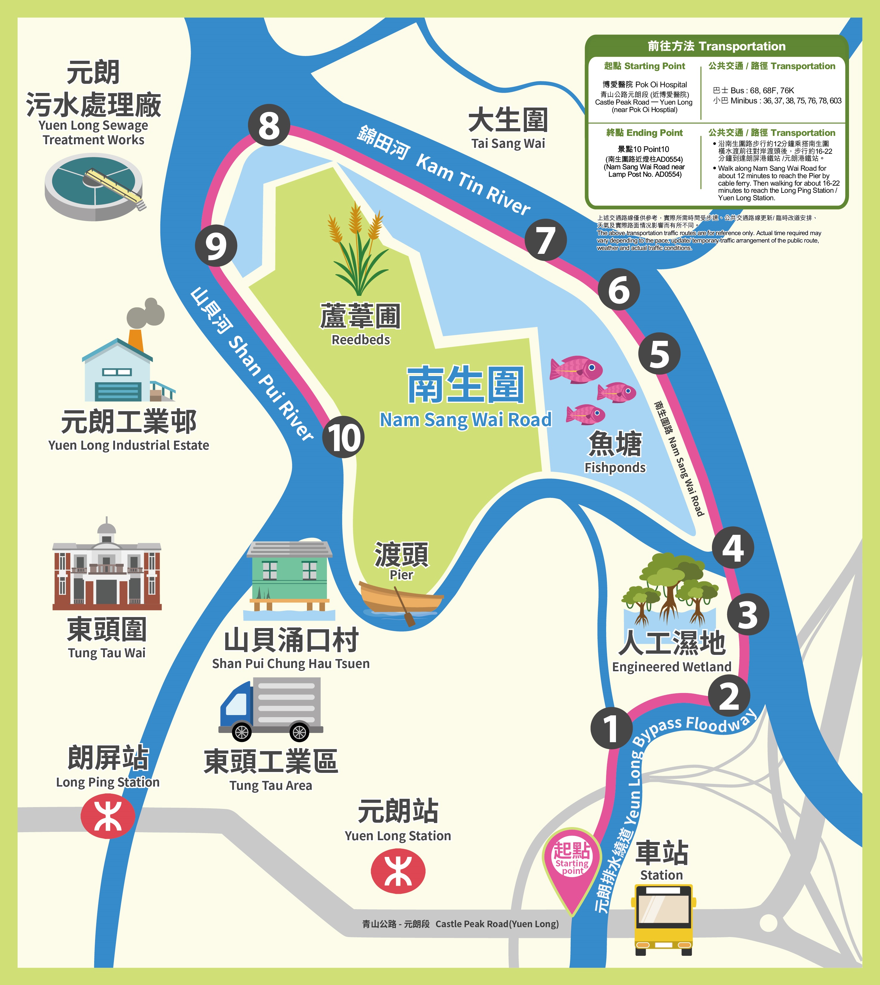
Nam Sang Wai River Education Trail
Nam Sang Wai River Education Trail
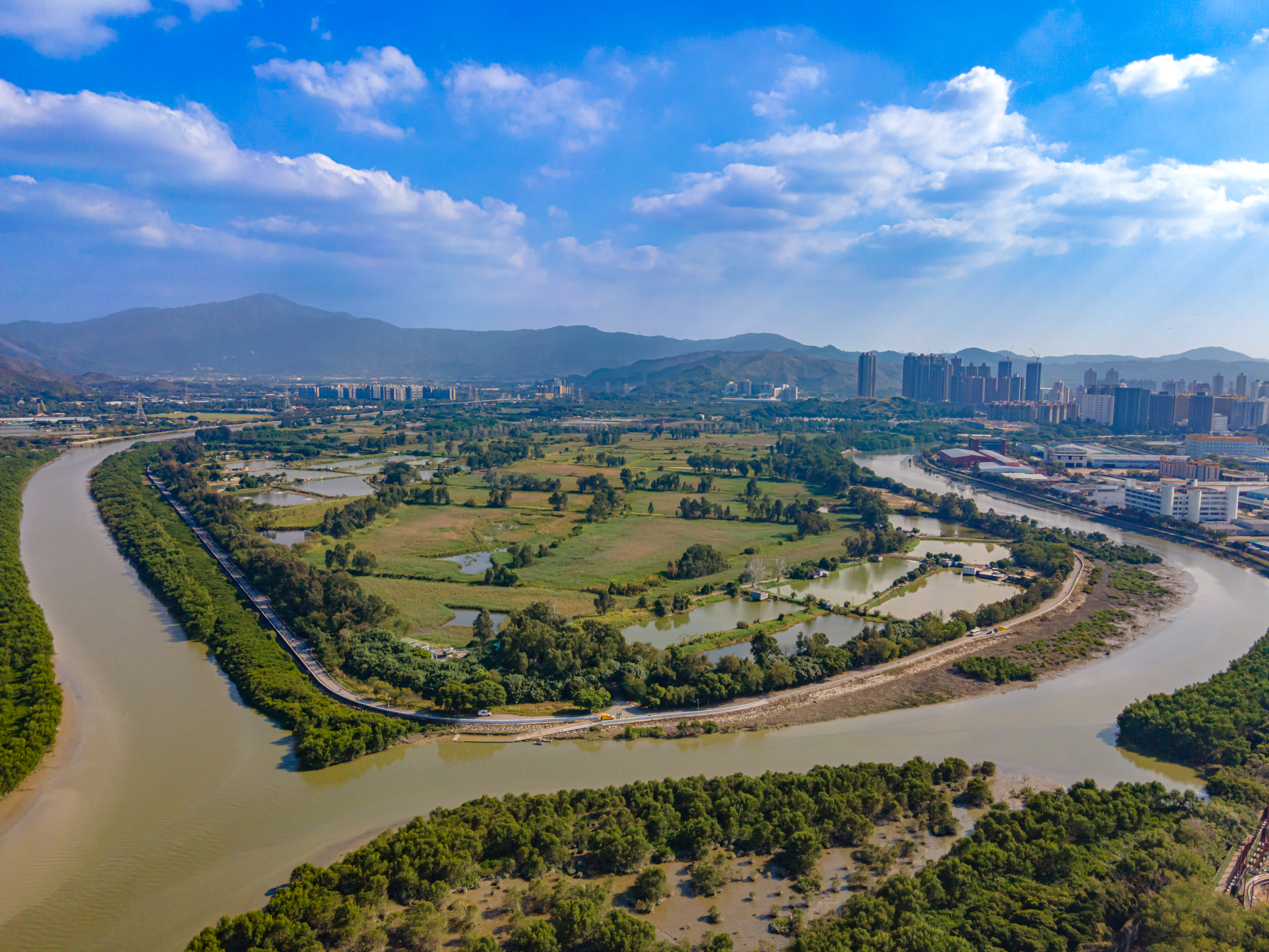
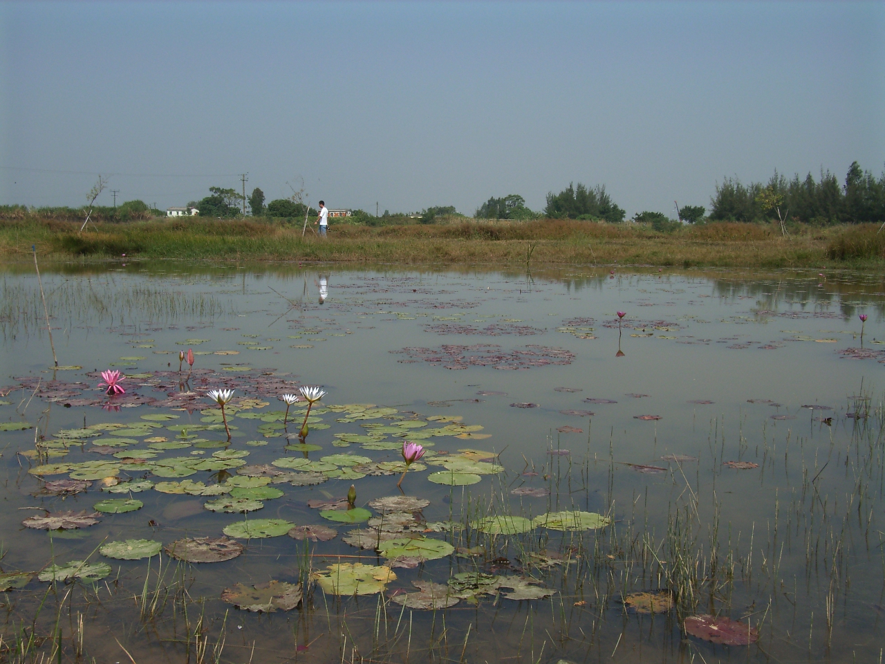
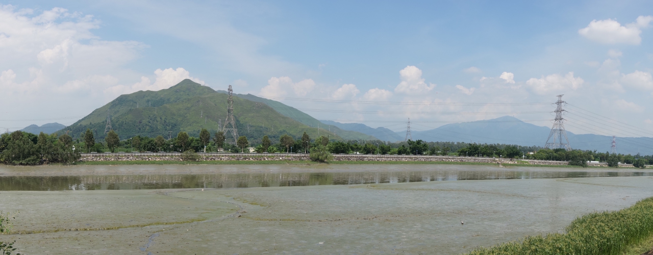
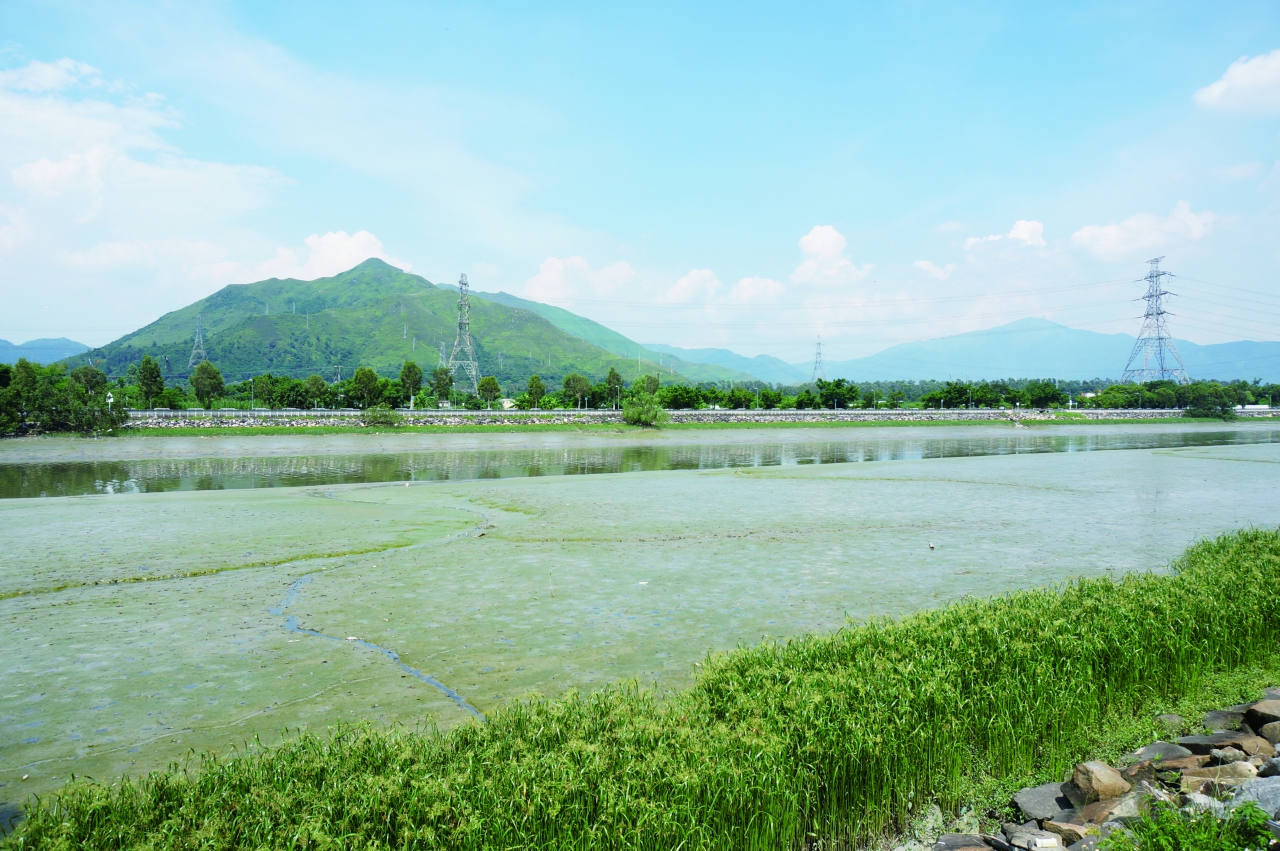
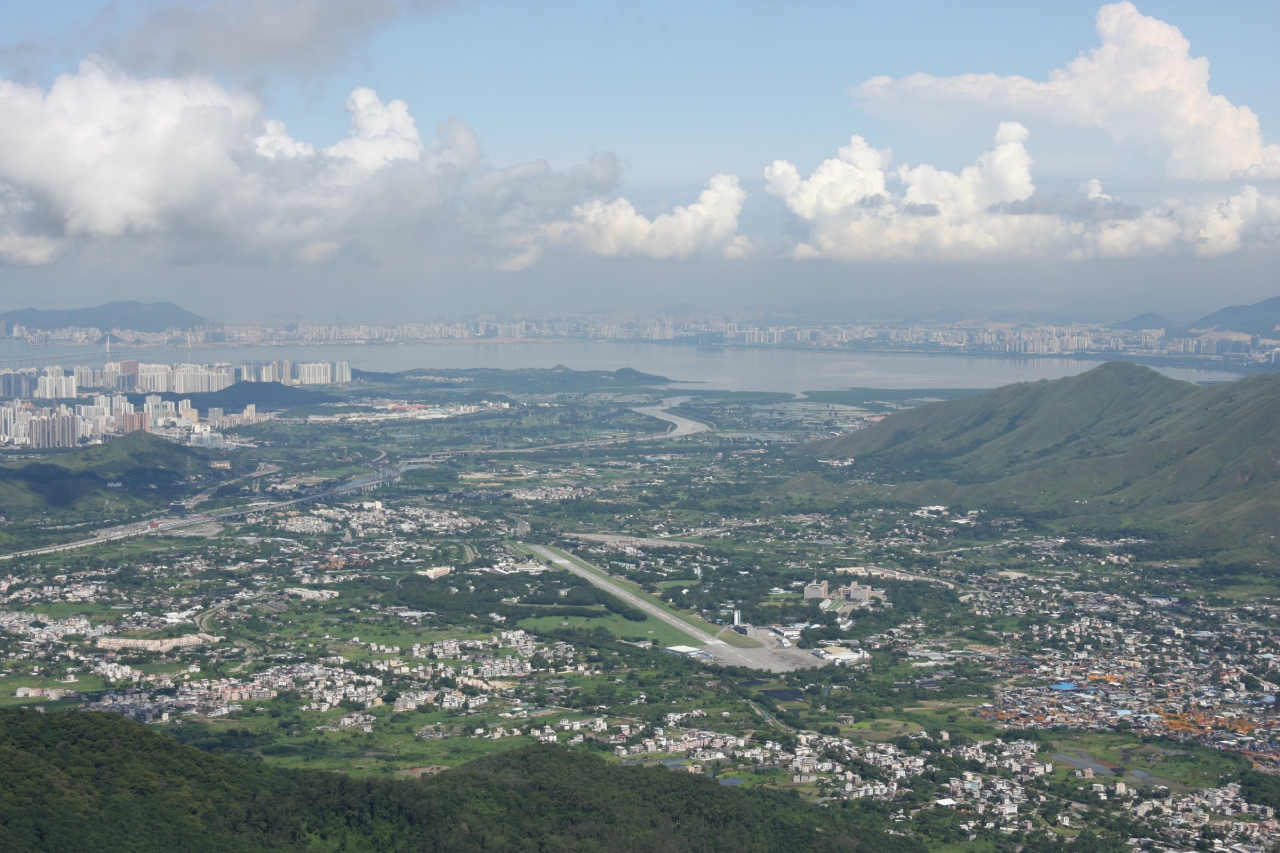
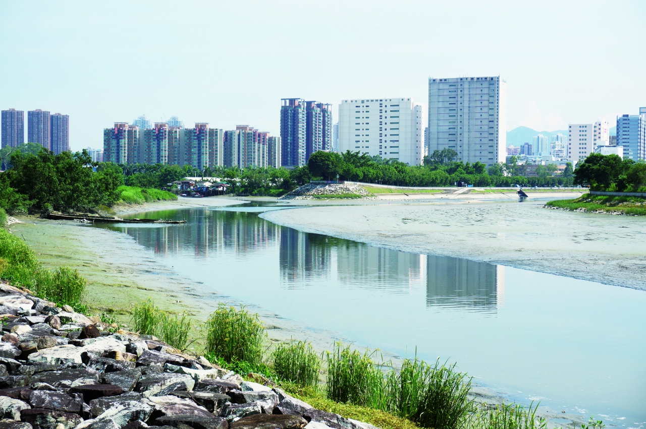
Confluence of Kam Tin River (Left) and Shan Pui River (Right)
Transportation
| Starting Point | Transportation |
|---|---|
|
Pok Oi Hospital |
Bus 768, 68F, 76K |
|
Castle Peak Road – Yuen Long (near Pok Oi Hosptial) |
Minibus 36, 37, 38, 75, 76, 78, 603 |
|
|
Walk for about 5 minutes to reach Point 1 |
| Ending Point | Transportation |
|---|---|
|
Point 10 (Nam Sang Wai Road near Lamp Post No. AD0554) |
Walk along Nam Sang Wai Road for about 12 minutes to reach the Pier by cable ferry. Then walking for about 16-22 minutes to reach the Long Ping Station / Yuen Long Station. |
The above transportation traffic routes are for reference only. Actual time required may vary depending to the pace, update/ temporary traffic arrangement of the public route, weather and actual traffic conditions.
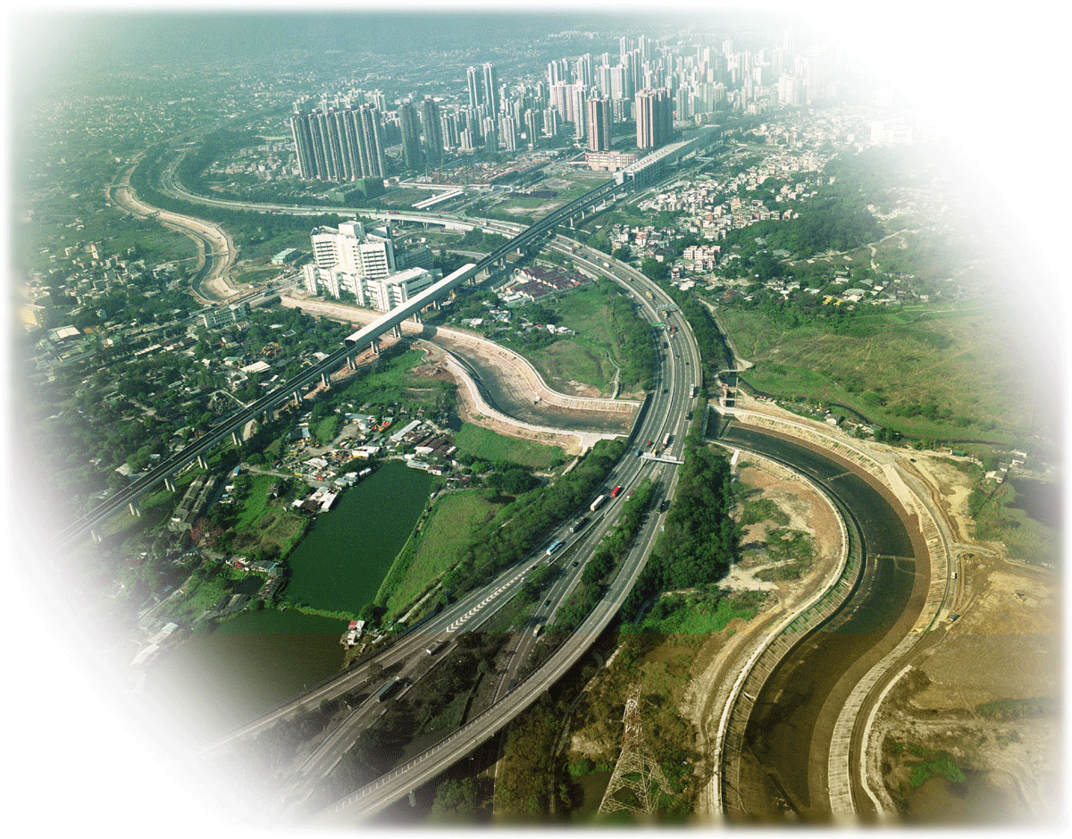
Aerial Photo of Yuen Long Bypass Floodway
Audio Guide
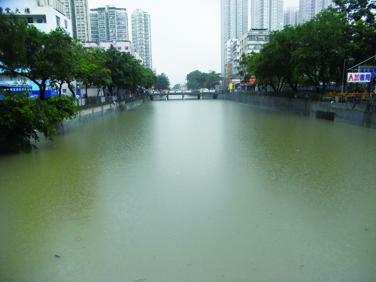
Shan Pui River and Kam Tin River have undergone major drainage works during the Yuen Long New Town Development in the 1970s. The drainage works have not only improved the flood prevention capacities of the two rivers but also changed the environment and ecology in the vicinity.
To promote the functions and values of major rivers and to enhance the public awareness on conservation of Hong Kong rivers, Drainage Services Department has designated this trail as "Nam Sang Wai River Education Trail".
The Nam Sang Wai River Education Trail starts at Castle Peak Road in Yuen Long, goes around Nam Sang Wai via the Yuen Long Bypass Floodway, new channel of Kam Tin River and Shan Pui River. The Trail is about 5.5 kilometres long and takes 2 hours to complete. There are 10 Exhibition Panels along the trail to provide information on river training works and ecological aspects of the rivers.
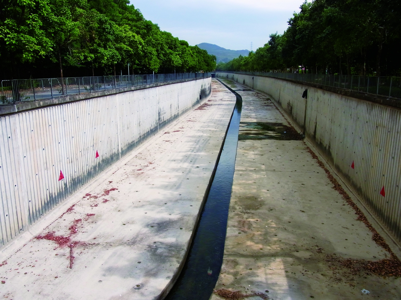
A Concrete Channel
Audio Guide
In Hong Kong, river training works are carried out mainly to solve flooding problems. In early days, river training works in Hong Kong meant straightening and deepening of natural channels and cementing riverbeds and riverbanks in order to discharge storm water as quickly as possible, which might cause damage to the natural hydrology, ecology as well as water quality. The complex natural setting comprising sand, mud, gravels and vegetation is replaced by smooth, bare and monotonous concrete surfaces. Rivers' natural environments and hydrology were ruined by such works, leading to ecological devastation and water quality deterioration.
Now, improved designs for channel and embankment construction are adopted to retain natural riverbeds and meanders. For example, in the 1990s the natural riverbeds were retained in Shan Pui River and Kam Tin River training works to provide habitats for animals. Mangroves were planted to enhance the channels' ecological value.
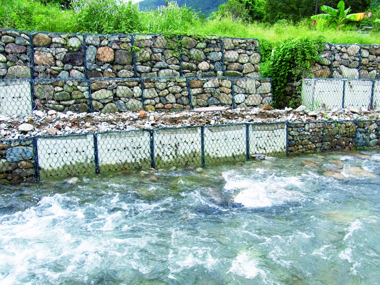
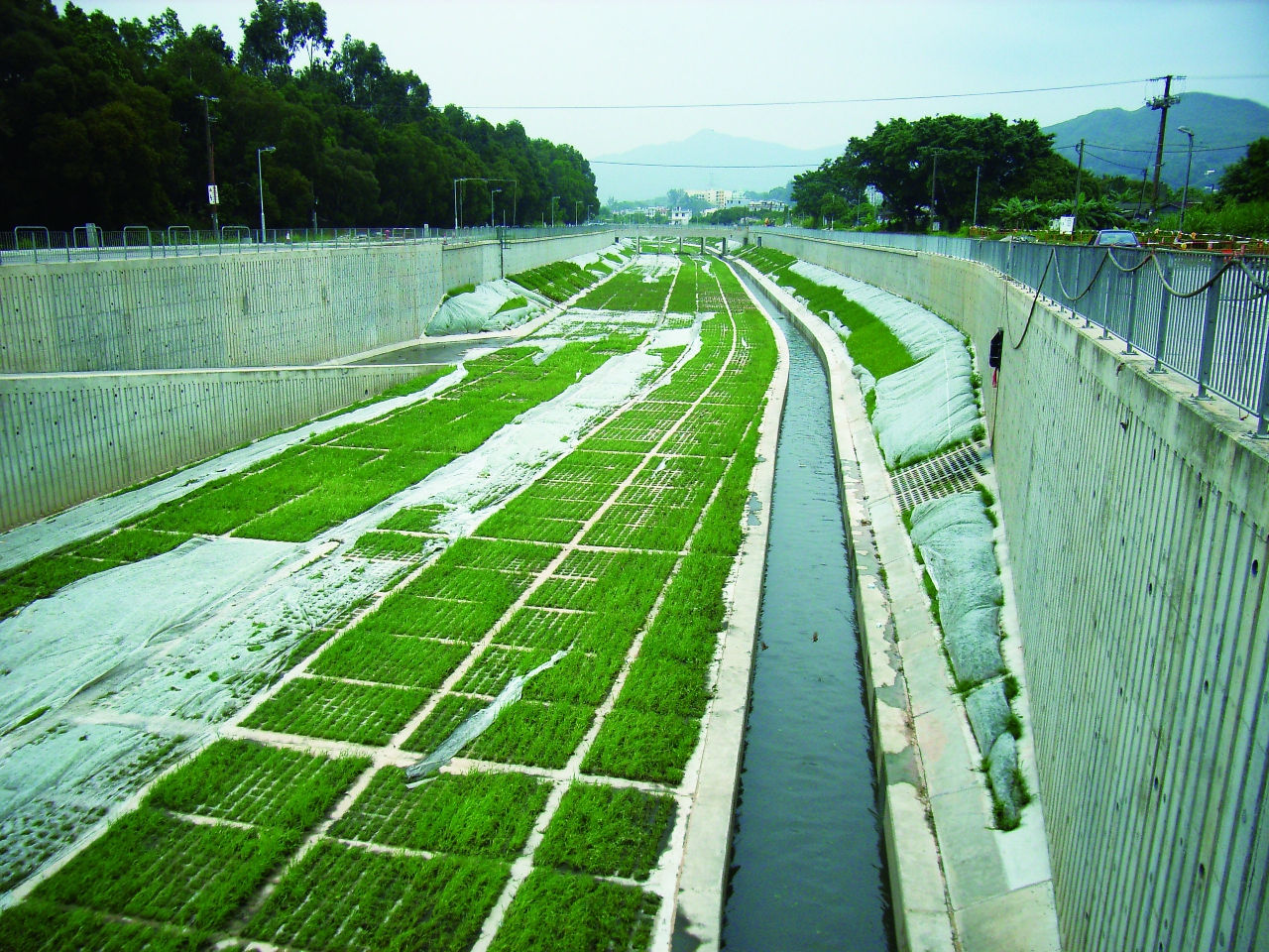
Practices have been improved to include grasscrete, rip-raps (rock armour) and gabions. Grasscrete – growing grass in the concrete grids; rip-rap – rock armour for river beds; and gabions - metal mesh baskets filled with stones for embankment construction, which are currently widely used.
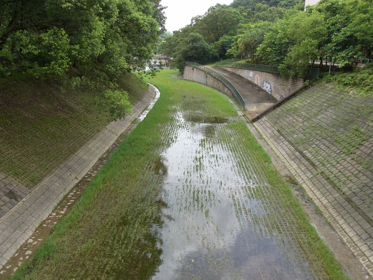
In front of you is the Yuen Long Bypass Floodway. The porous "grasscrete" paving of the channel allows the flow between river water and groundwater and supports plant growth. It was also designed to be meandering instead of straight, mimicking the natural alignment. This makes the channel look more natural.
However, existing river training techniques still affect natural rivers' ecology and hydrology. As technology advances, we long for more environment-friendly river training works.
You may find out other improved designs along this Trail. Are these designs bringing positive or negative impacts to flood prevention, landscape, ecology and water quality?
Grasscrete
Rip-raps
Gabions
Yuen Long Bypass Floodway was Designed to be Meandering
River Channel after Rainstorm
Audio Guide
Yuen Long Plain is a low lying area and was used to suffering from flooding frequently. In order to lower the risk of floods in Yuen Long town situated to the north of the plain, Yuen Long Bypass Floodway was constructed along the southern side of Yuen Long Highway, southeast of Yuen Long town. Yuen Long Bypass Floodway diverts the flow of Shan Pui River near the south of Yuen Long Town Centre to the new channel of Kam Tin River, in order to relieve the flood risk in Yuen Long Town Centre.
Yuen Long Bypass Floodway stretches some 3,800 metres, with a width of over 20 metres and a dry weather flow at the bed, and diverts 40% of rainwater of Yuen Long area to the new channel of Kam Tin River. Plant growth was artificially encouraged along the lower stream with "grasscrete". The surface of the concrete in this section was pierced with cavities, which were filled with soil, and vegetation was allowed to grow. Therefore, green plants thrive along the artificial channel, thus improving the appearance of the channel.
In addition to grasscretes, there is a shallow pond which is 350 metres in length and 1.8 hectares in area (equivalent to 18 full size swimming pools) constructed at the downstream of the Yuen Long Bypass Floodway. Various wetland plants are planted in the pond and along the banks to provide a wetland habitat for the flora and fauna, creating an ecological compensation for this project.
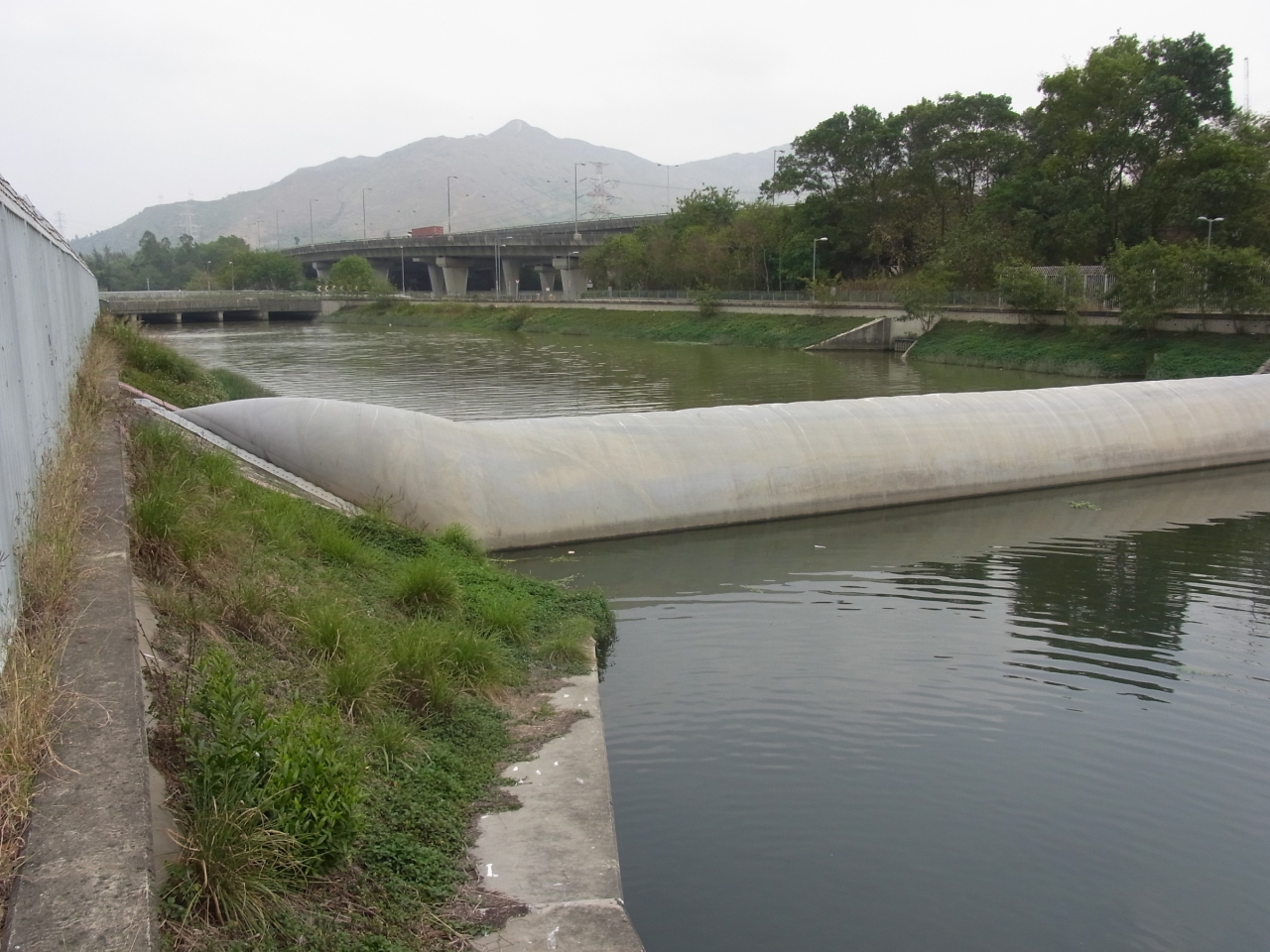
An inflatable dam is installed about 180m ahead of the confluence of Yuen Long Bypass Floodway and the new channel of Kam Tin River. It blocks the backflow of polluted river water to Yuen Long Bypass Floodway during high tides, so as to prevent nuisance-causing odour and rubbish from affecting nearby residents at the upstream area.
Yuen Long Bypass Floodway that you can see right ahead is a channel constructed by land excavation, as transforming the original rivers is no longer sufficient in dealing with the increase of discharge resulted from urbanisation.
Grasscretes in Yuen Long Bypass Floodway
A Shallow Pond in Yuen Long Bypass Floodway
Plants Flourish in the Yuen Long Bypass Floodway
An Inflatable Dam Installed in Yuen Long Bypass Floodway
Overlook of the Engineered Wetland
Audio Guide
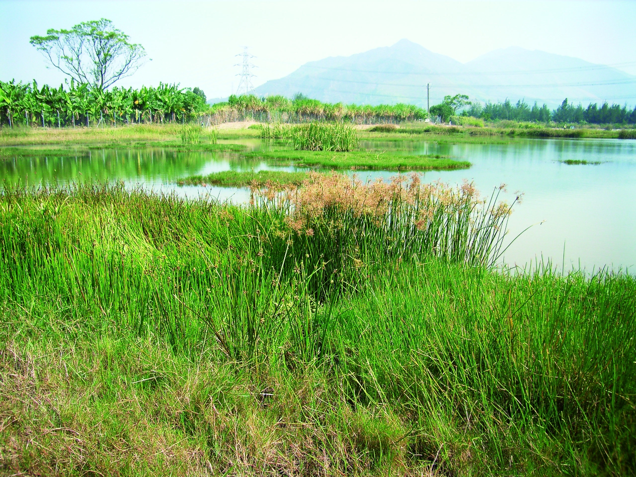
A 7-hectare engineered wetland is provided near the downstream area of Yuen Long Bypass Floodway. The wetland was built from three abandoned fishponds, with an area equivalent to 10 football pitches, to compensate for the loss of fishponds and farmlands and to provide a habitat for birds, frogs, bats and dragonflies. A bamboo grove was also planted to the south of the wetland to attract egrets.
Human activities such as operating restaurants, car-repair workshops and farming leave food debris, chemicals, fertilizers and pesticides on roads or soil. During rainstorms or street cleaning, these pollutants will be washed into Yuen Long Bypass Floodway directly or through stormwater drains. Such pollutants, which are not from fixed locations, result in "non-point source pollution".
A natural ecological system automatically serves mankind through various "ecological services", such as provision of oxygen and degradation of pollutants. The engineered wetland purifies the flow of Yuen Long Bypass Floodway by natural process. The wetland consists of three Main Ponds, a Deep Pond, a Seasonal Shallow Pond, and a Permanent Shallow Pond. The water is pumped through ponds with crushed bricks and oyster shells to deposit and filter out suspended solids, while the nutrients are absorbed by reedbeds. The water then flows through some ponds for further purifications by the wetland ecosystem before discharging to Kam Tin River.
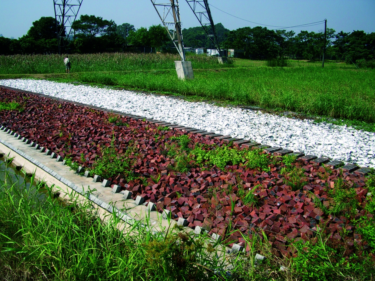
Ponds with Crushed Bricks and Oyster Shells
Reedbeds
Water Lily Pond in the Engineered Wetland
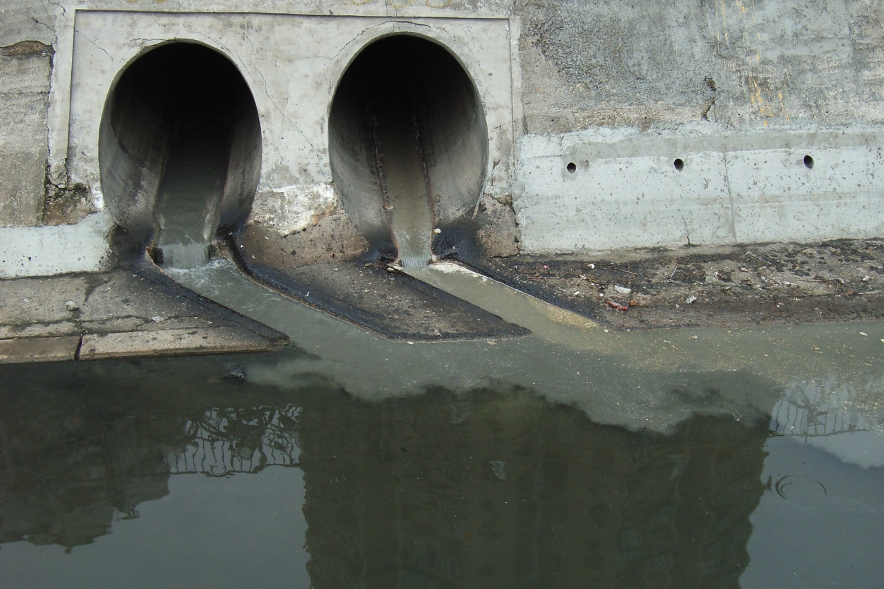
Non-point Source Pollution from Stormwater Drains
Old Channel of Kam Tin River
Audio Guide
The section of the Kam Tin River in front of you was completed in 1997. In the past, the typical meanders of the narrow and winding old Kam Tin River was unable to rapidly discharge floodwaters from torrential rainstorms, and low-lying areas of Kam Tin were inundated.
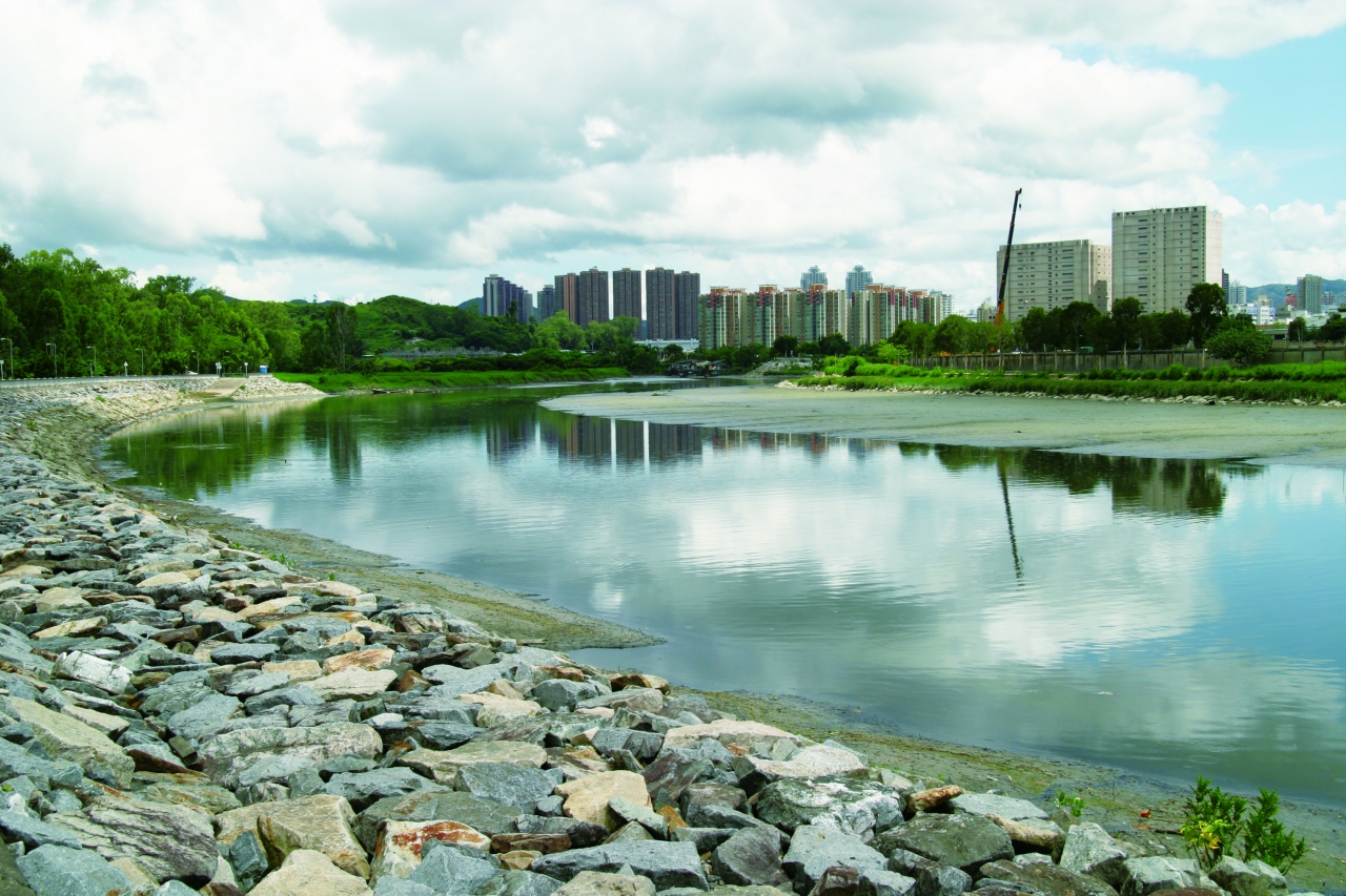
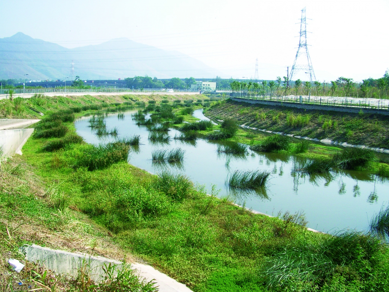
To solve the flooding problem in Kam Tin area, enhancing the drainage capacity of Kam Tin River is one of the options. At the downstream area of Nam Sang Wai, a new channel of 120 metres wide and 3 kilometres long is built by excavating some fishponds in the vicinity. This new channel runs straightly to Shan Pui River and increase the drainage capacity of Kam Tin River.
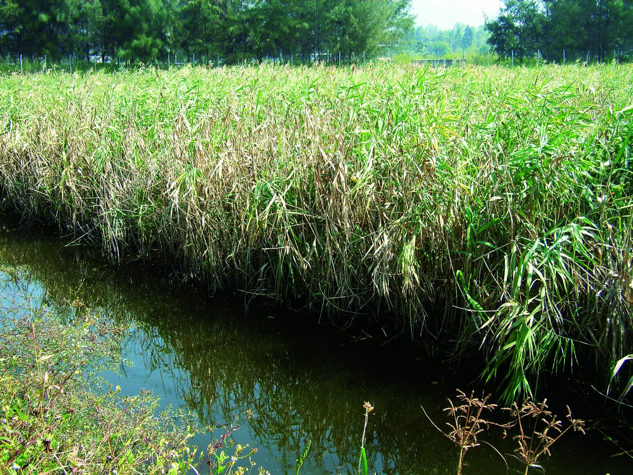
Here is the junction of the new and the old channels of Kam Tin River, which was also once the downstream of Kam Tin River. Since the completion of the new channel in 1997, the old channel has become disconnected with Kam Tin River. The new channel design keeps the river bed natural, providing habitats similar to the original wetland environment, and allows wildlife to find shelter, forage and breed. At present, mudflats are exposed on the riverbed as the tide ebbs.
You may take the path behind to have a look of the old channel of Kam Tin River there. Different from the new channel which is wide and straight, the old channel is narrow and meandering with dense plants along the banks. This was the original lower course of Kam Tin River, converging with Shan Pui River at Chung Hau Tsuen.
New Channel of Kam Tin River
Mudflats are Exposed on the Riverbed of New Channel of Kam Tin River as the Tide Ebbs
Kam Tin River Basin is Bounded by Hills including Kai Kung Leng (left) and Tai Mo Shan (right)
Audio Guide
Rainwater falling on Kam Tin Plain and surrounding mountain ranges will form streams, which eventually converge to Kam Tin River and feed into Deep Bay.
Kam Tin River originates from Hong Kong's highest peak, Tai Mo Shan. Its main stream begins to the north of the peak of Tai Mo Shan, at an altitude of 910 metres, which is the second highest origin of a Hong Kong river (The highest is Tai Shing Stream, which starts at an altitude of 930 metres). Bounded by the watersheds of Tai To Yan to the east, western ridge of Tai Mo Shan to the south, Ho Hok Shan to the west and Kai Kung Leng to the north, the rhombus-shaped basin covers an area of about 44.3 square kilometres. Rainwater finds its way into streams and tributaries, eventually feeding Kam Tin River.
As Kam Tin River collects all the rainwater falling on the whole river basin, the water level rises rapidly during heavy rainstorms. If the river channel cannot hold the rising waters, flooding occurs.
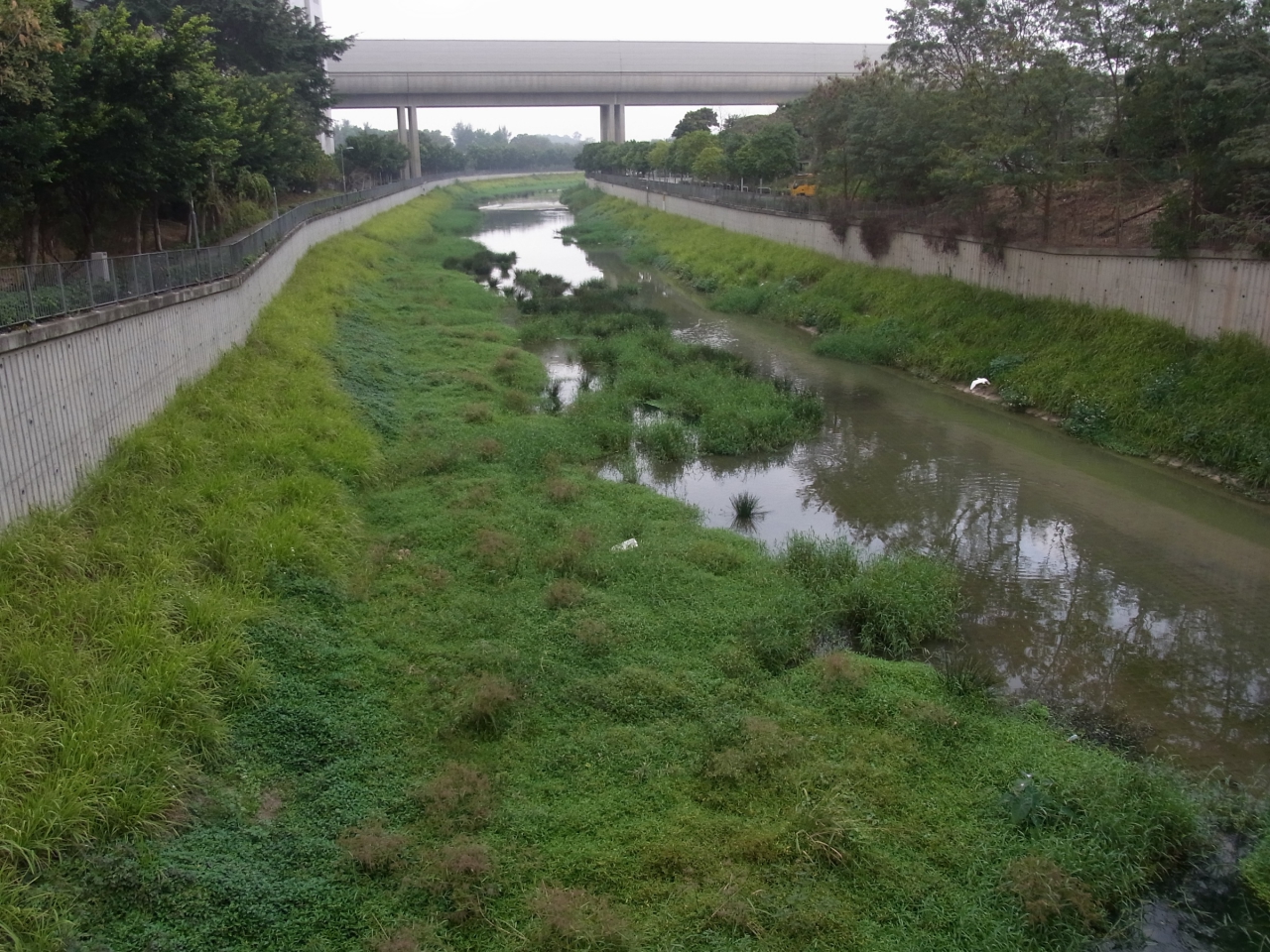
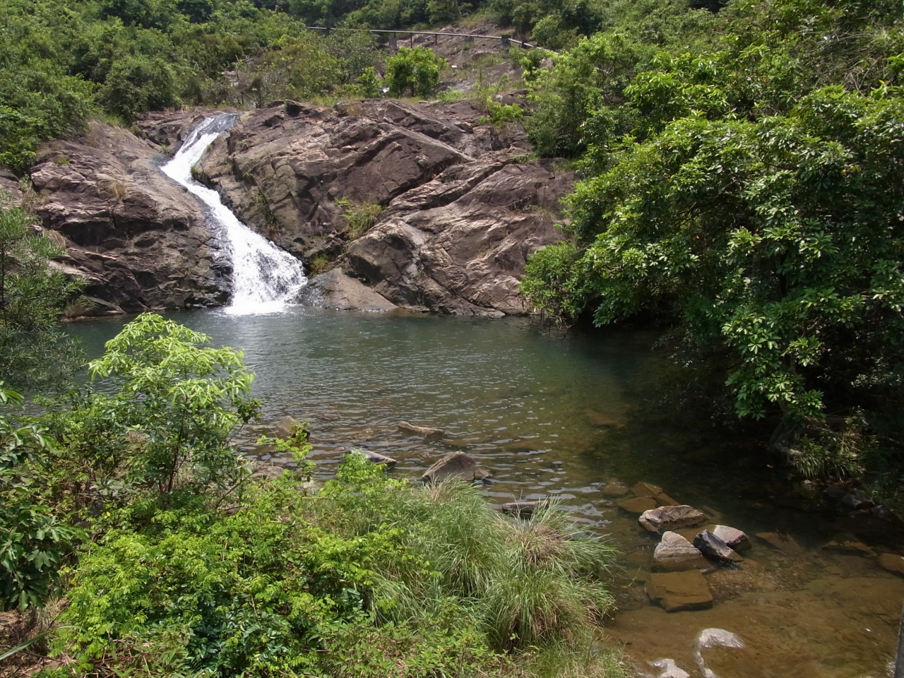
Most tributaries at upstream are steep and narrow. Strong down cutting creates various river landforms including V-shaped valleys, interlocking spurs, rapids and potholes. If the geology is suitable, waterfalls, plunge pools and gorges may form. Here, the downstream of Kam Tin River looks wide and flat. The major river landform of the lower course is meanders. However, due to river training works, most meanders are now fragmented.
Viewing from here, Kai Kung Leng is to your left while Tai Mo Shan is to your right. The flow runs from upstream of these mountains to downstream here.
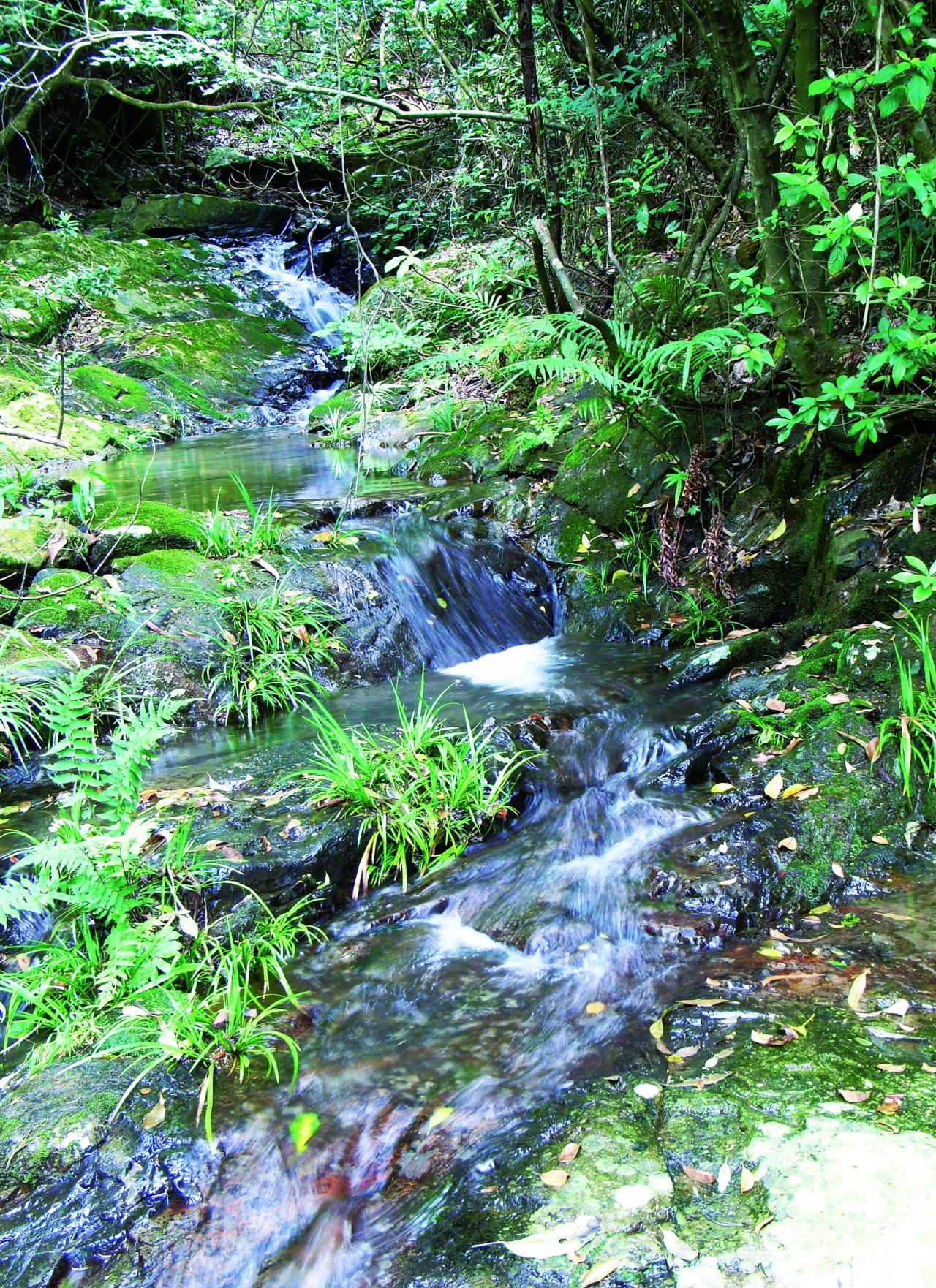
The Upstream mostly Comprises Steep, Shallow and Narrow Streams
The Upper Course of Kam Tin River at Ho Pui
View of Kam Tin River Basin from Tai Mo Shan
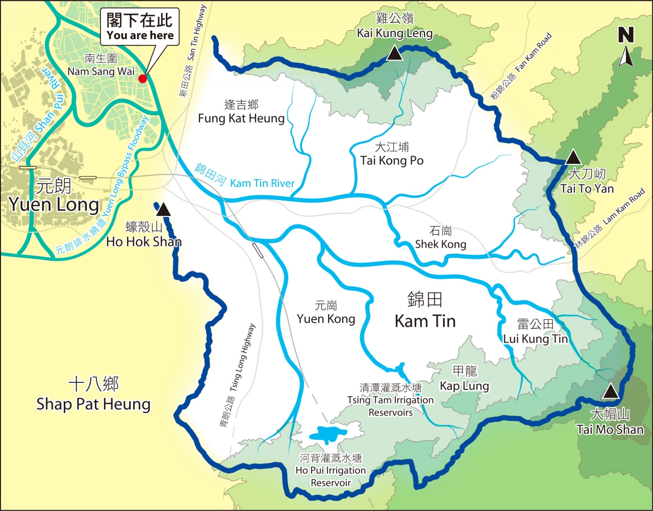
Map of the Basin
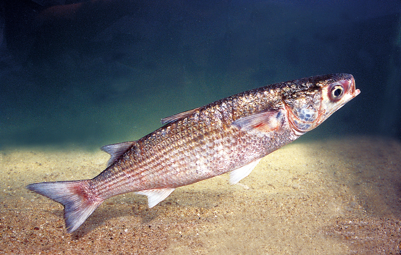
Grey Mullet (Mugil cephalus)
Audio Guide
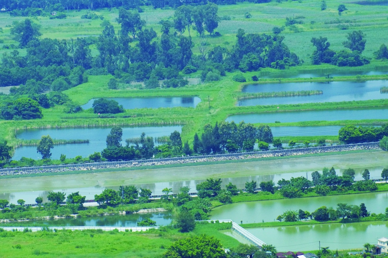
There are many fishponds in Yuen Long. The flat and extensive flood plain at Shan Pui River estuary and Nam Sang Wai has clay soil making it suitable for building fishponds. Fishpond and gei wai culture started in the 1930s to 1940s. In the 1960s, aquaculture in Deep Bay area began to thrive and many paddyfields and gei wai were converted to fishponds, transforming Yuen Long into the largest fishpond area in Hong Kong. Nowadays, a number of them have undergone urban development. For example, the new channel of Kam Tin River is constructed by excavation of several fishponds, and those little pools in triangular shape beside it are actually parts of the original fishponds.
The 1980s was the peak period for Hong Kong's fishpond culture industry. In 1986, the area of fishponds in Hong Kong was about 2130 hectares, and production peaked at 6000 tonnes. Facing severe competition from freshwater fish originating from mainland China, and due to urbanization and water pollution, the fishpond culture industry has been diminishing since the 1990s. In 2012, fishponds occupied 1150 hectares, and 2306 tonnes of fish were produced.
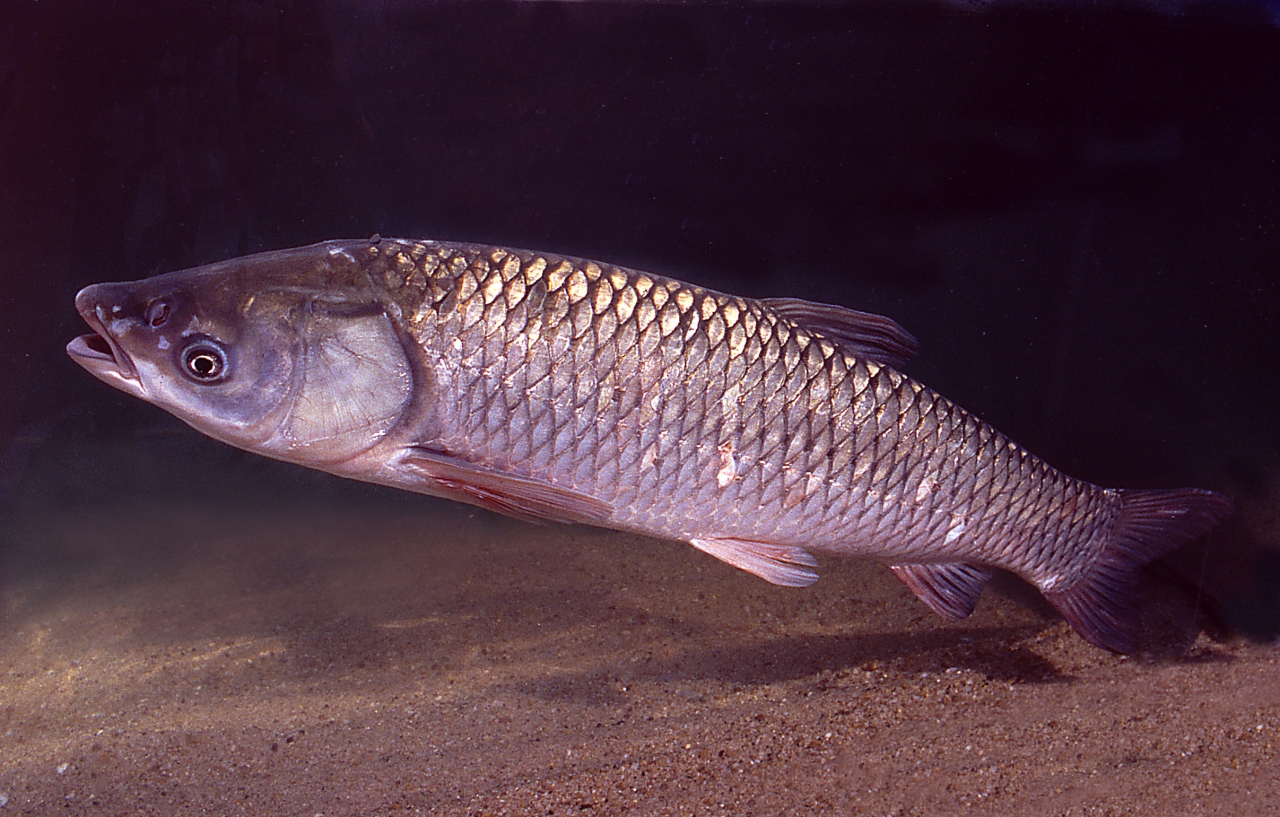
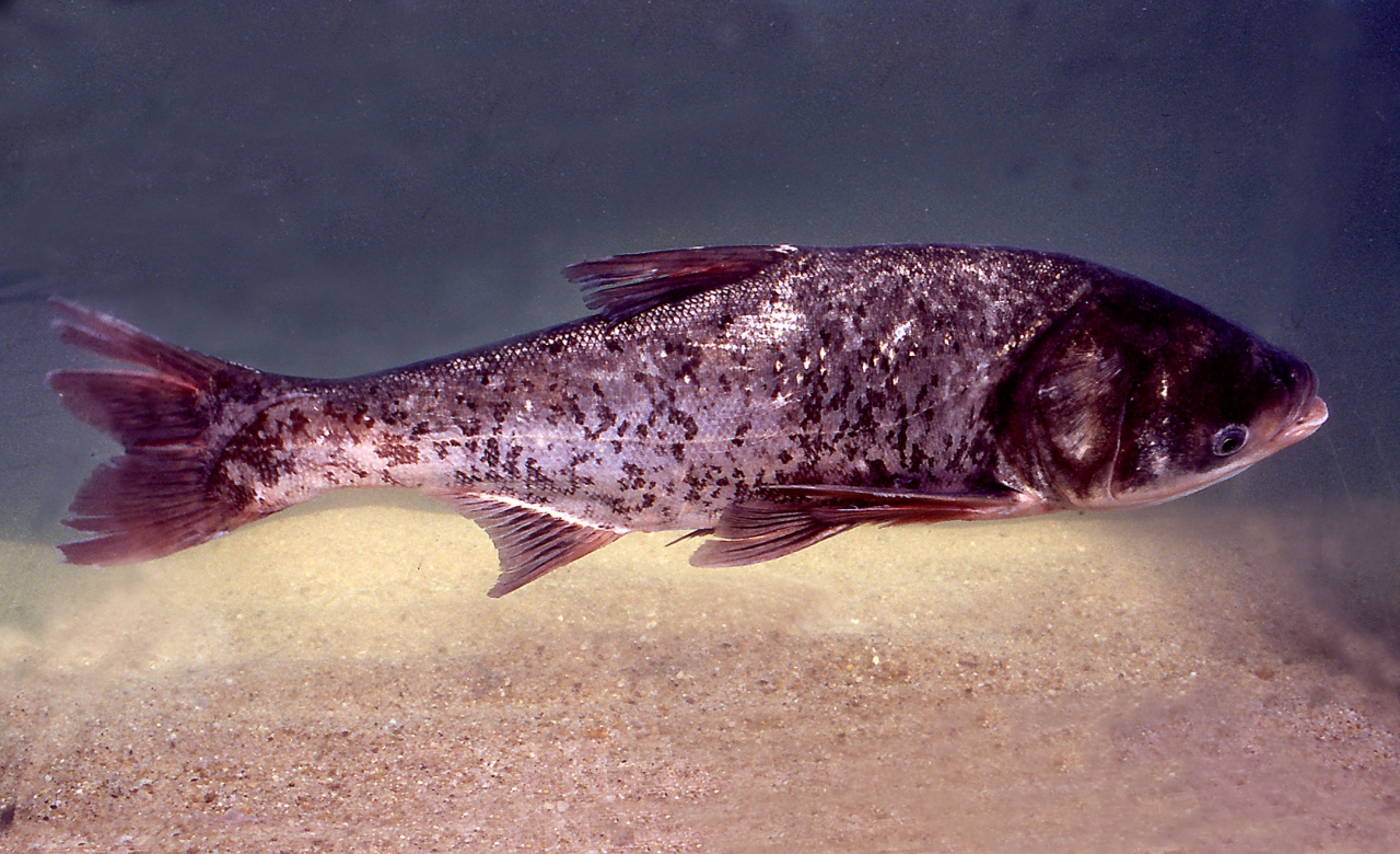
Traditionally, cultivated fish in local fishponds included: Common Carp (Cyprinus carpio), Silver Carp (Hypophthalmichthys molitrix), Mud Carp (Cirrhinus molitorella), Grass Carp (Ctenopharyngodon idellus) and Big Head Carp (Aristichythys nobilis). Grey Mullet (Mugil cephalus) was the specialty product of Yuen Long fishponds, and Deep Bay was the nursery ground of the fish. In the past, fishermen could harvest the fry in the estuary between winter and spring, and then raise them in the fishponds. The practice is no longer feasible because of pollution in Deep Bay. Fish fry are now mainly imported from mainland China and Taiwan. Recently, local fishponds have successfully cultivated species such as Pompano (Trachinotus blochii), Giant Perch (Lates calcarifer) and Giant Grouper (Epinephelus lanceolatus).
Fishponds have a high ecological value in addition to aquaculture use. A number of adjacent fishponds can form a wetland habitat for waterfowl and other wildlife. When fishponds are drained for harvesting and cleaning, the small fish and invertebrates that remain becomes a banquet for birds. This is a good example of how human activities can exist in harmony with nature. Fishponds are also used for stabilizing microclimate and storing stormwater.
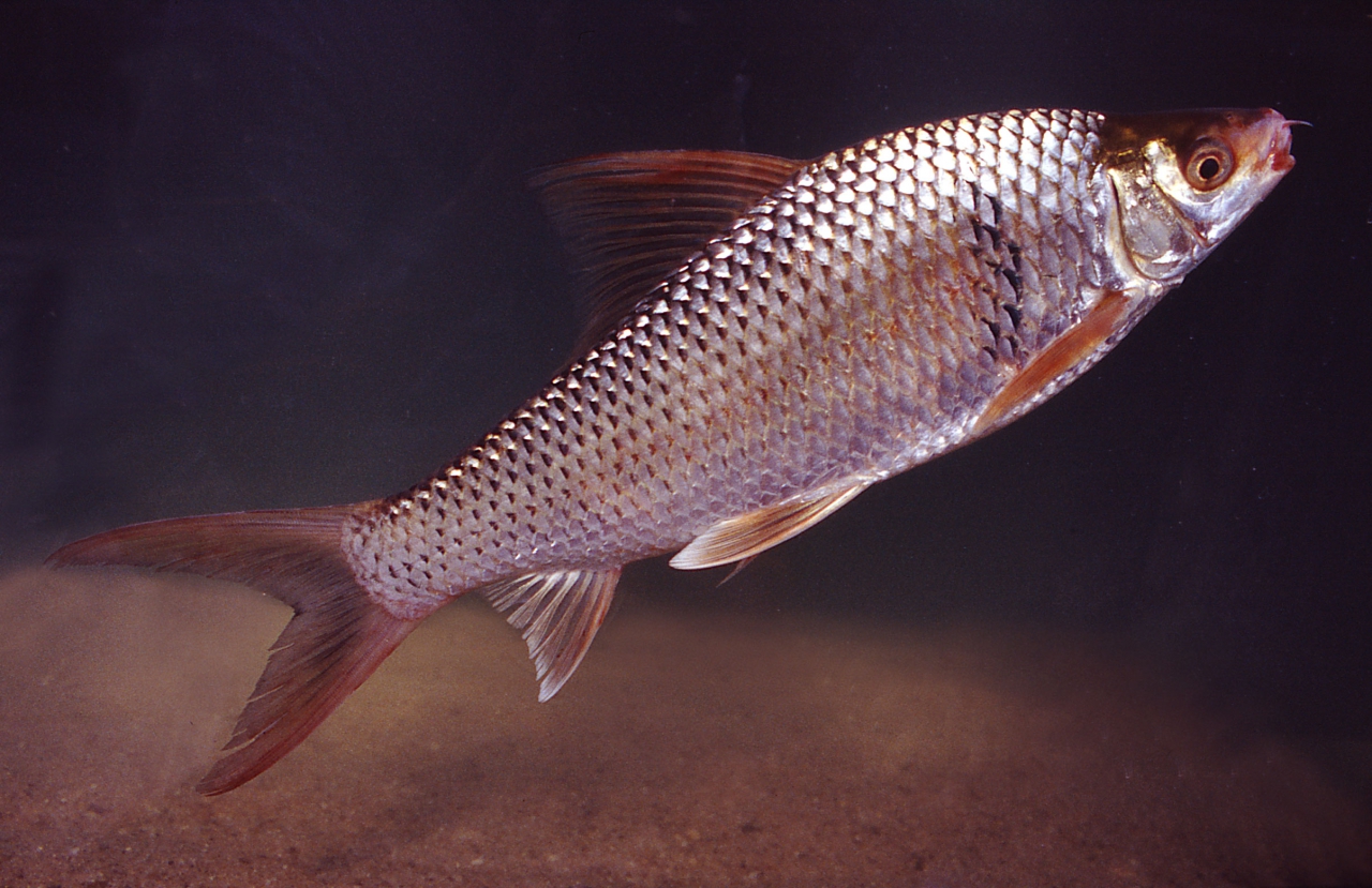
Mud Carp (Cirrhinus molitorella)
Grass Carp (Ctenopharyngodon idellus)
Big Head Carp (Aristichythys nobilis)
The New Channel of Kam Tin River is Constructed by Excavation of Fishponds
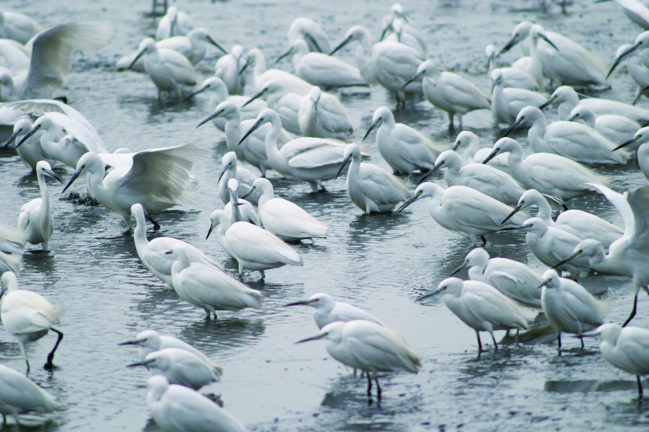
Flock of Egrets Foraging at a Fishpond
Flock of Egrets Foraging at a Fishpond
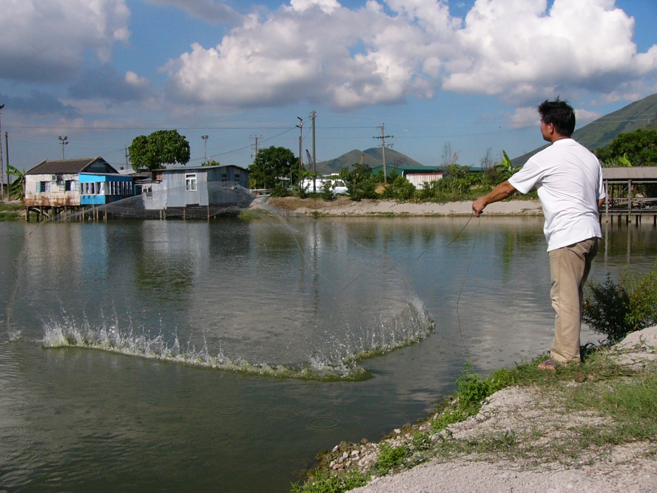
A Fisherman is Releasing a Fish Net to Catch Fish
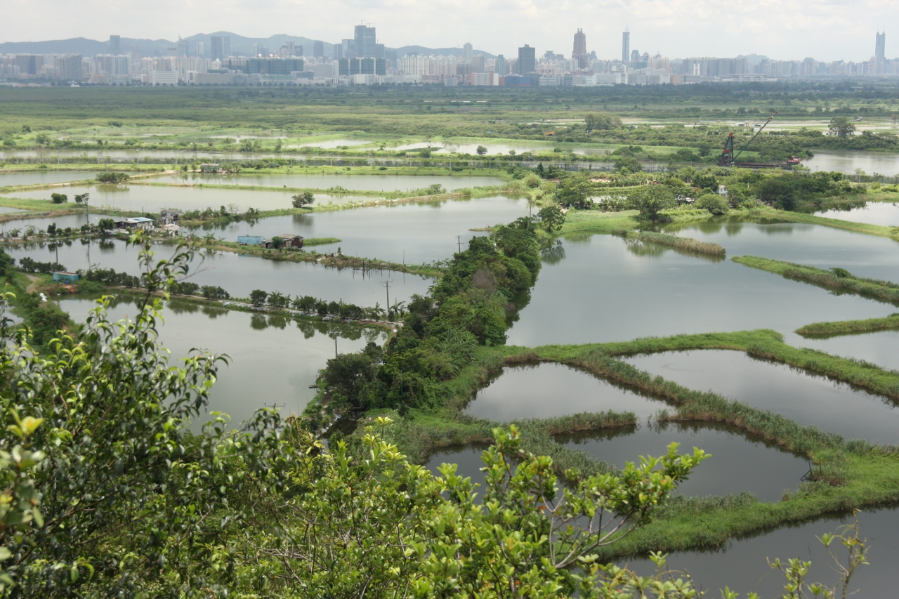
A Number of Adjoining Fishponds
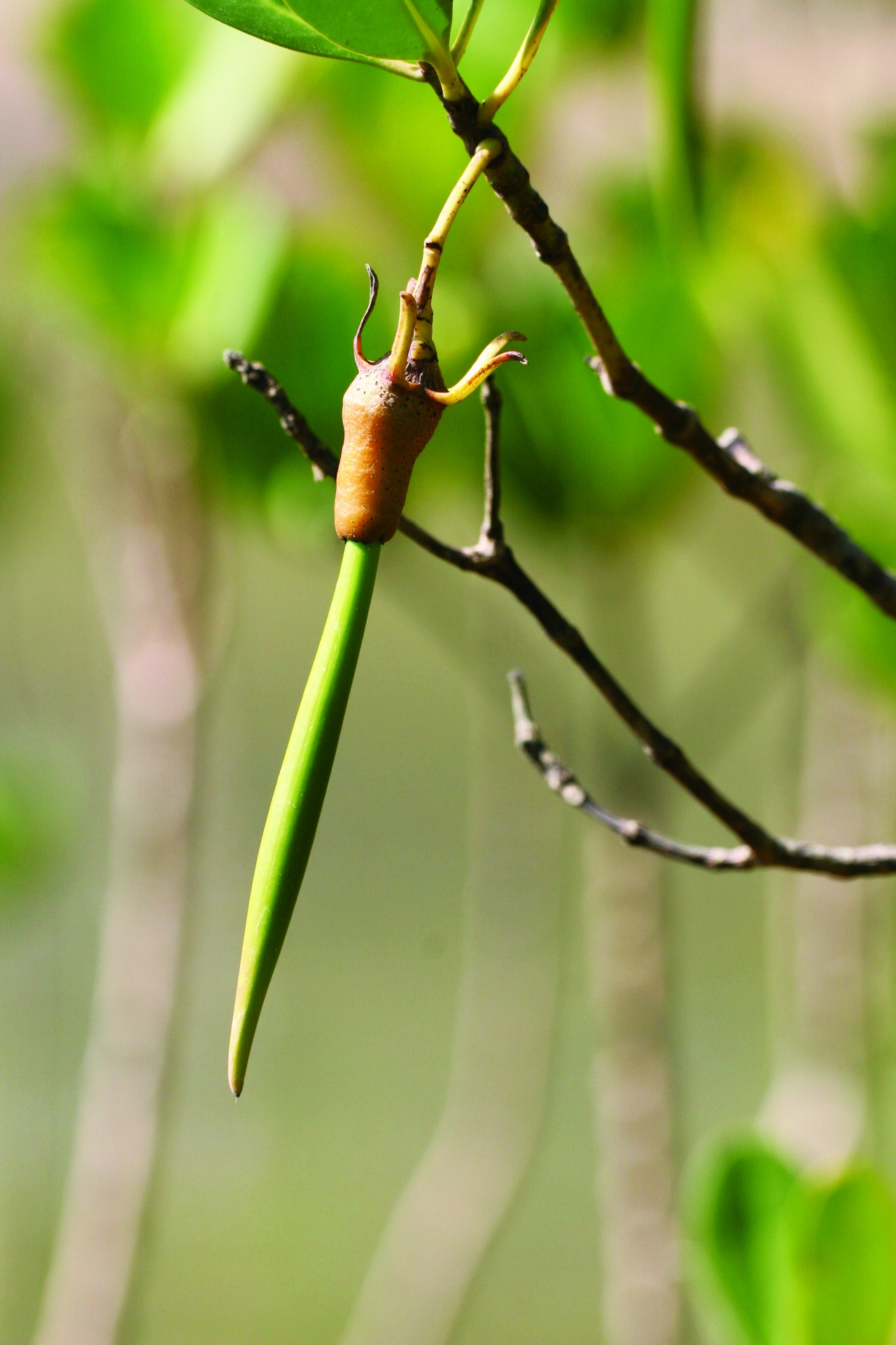
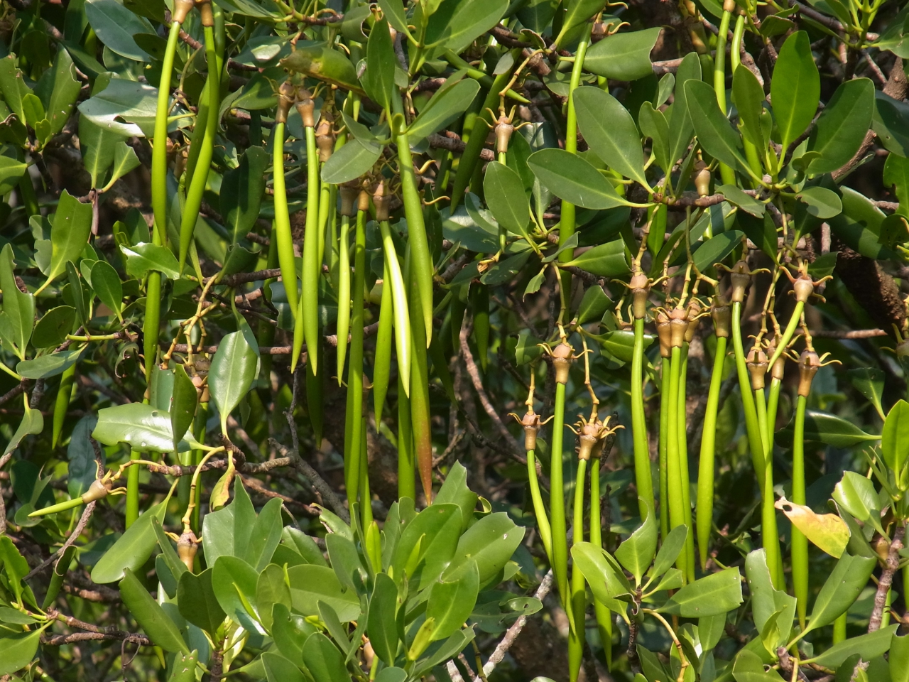
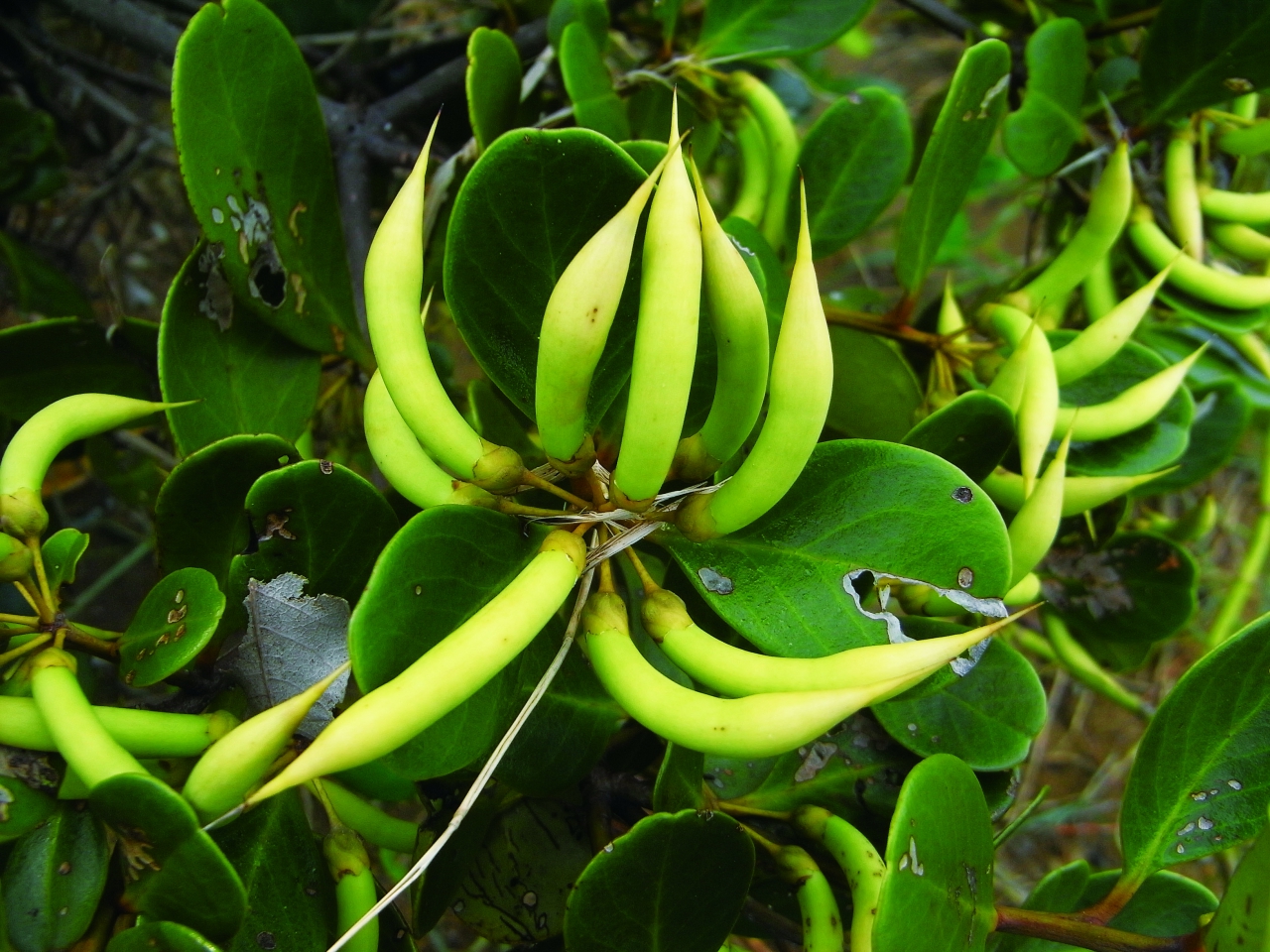
Kendelia (Kandelia obovata)
Audio Guide
The new channel of Kam Tin River along Nam Sang Wai was constructed in 1997. To compensate for the wetland disrupted by the works, mangroves including Kandelia (Kandelia obovata) and River Mangrove (Aegiceras corniculatum), as well as mangrove associates such as Spiny Bears Breech (Acanthus ilicifolius), are planted along the riverbanks of the new channel and Shan Pui River. Mangroves not only help enrich the ecosystem, but also strengthen riverbanks.
Mangroves grow in estuaries and lower streams of tidal rivers. By observing the mud mark left on the leaves, you can have a rough idea of the level of high tide. The mudflats are covered by seawater during high tides, and the salinity fluctuates with tides. Loose, deoxygenated soil is a difficult substrate for most plants to establish. Brutal as these conditions may seem, mangroves thrive here thanks to their special adaptations.
Mangrove species have special adaptations to withstand fluctuating salinity, such as salt glands in leaves to excrete salt, or storing salt in leaves and shedding them to control their salt balance.
"Prop roots" in the shape of arches, laterally growing "cable roots" and large and thick vertical "buttress roots" are special features of mangrove species to improve their anchorage in the unstable substratum.
Certain mangroves can be distinguished by their pen-like "droppers" hanging on tree branches. Droppers are germinated seeds that allow better survival and faster growth on the muddy tidal shore. Droppers can plunge into soil after dropping from plants, or float in the water. The droppers have a characteristic shapes, which help to identify mangrove species.
The bark of mangroves contains a chemical called tannin. This is extracted to make red dye, giving rise to the Chinese name for mangroves: Red Trees.
Kendelia (Kandelia obovata)
River Mangrove (Aegiceras Corniculatum)
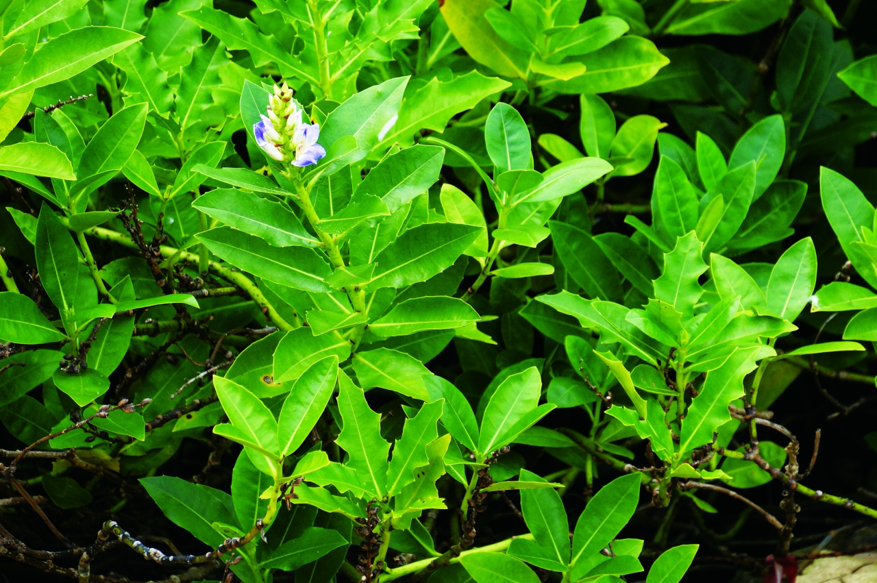
Spiny Bears Breech (Ilicifolius)
Mud Mark Left on the Leaves of Mangroves Indicates the High Tide Level
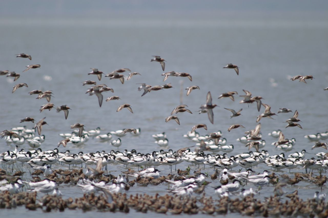
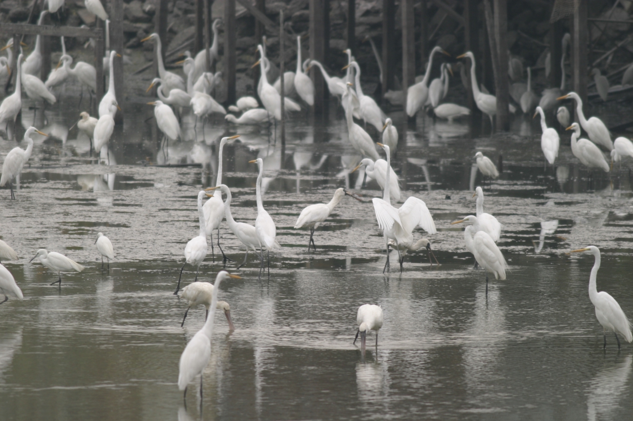
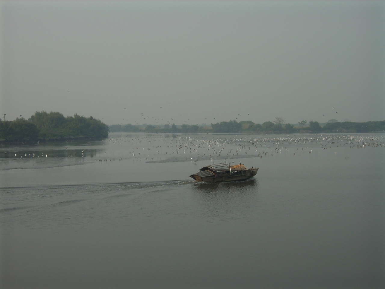
Thousands of Migratory Water Birds Visit Deep Bay during Winter
Audio Guide
Formed by the deposition of sediments in the estuaries of Kam Tin River, Shan Pui River and other rivers, the extensive mudflats near Deep Bay serve as an important habitat for waterfowl. Every winter, tens of thousands of migratory birds including a number of globally endangered species stay here. Thus, the wetlands in Deep Bay area including intertidal mudflats, mangroves and fishponds are of international significance.
On 4th September 1995, an about 1,500-hectare area of mudflats, mangroves and fishponds in Mai Po and Inner Deep Bay was officially listed as a Ramsar Site for its international significance. "Ramsar Site" originates from the Ramsar Convention – or the Convention on Wetlands of International Importance especially as Waterfowl Habitat, which many countries signed on 2 February 1971 in the Iranian city of Ramsar, with the aim of promoting wise use and protection of wetlands. 2 Feburary each year is then designated as World Wetland Day to mark the date of adoption of the Convention.
There are several criteria a site must meet in order to qualify as a Ramsar Site. For example, Mai Po and Inner Deep Bay host over 20,000 waterbirds each winter; these include substantial numbers of endangered species such as Black-faced Spoonbill (Platalea minor). As well as the waterbirds, Inner Deep Bay's flora and fauna include 17 species of mammals, 21 reptiles, seven amphibians, 37 fish, over 400 invertebrates and 140 plants. The site indeed has high ecological value and is Hong Kong's prime ecological treasury.
Although most of Kam Tim River and Shan Pui River are not incorporated in the Ramsar Site, they play an important role in the wetland system by providing sediments and nutrients. To protect the Ramsar Site's ecology, several measures were adopted at the estuaries when river training works for Kam Tin River and Shan Pui River were carried out. They included preserving a number of fishponds, planting mangroves along riverbanks and retaining natural riverbed soil, etc.
In recent years, many waterbirds have gathered in the estuary at Nam Sang Wai to feed during the winter, in turn attracting crowds of people to watch them.
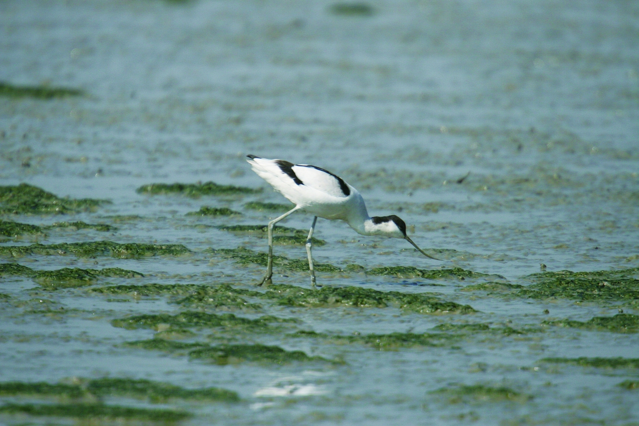
Pied Avocet, with its Distinctive Upturned Bill
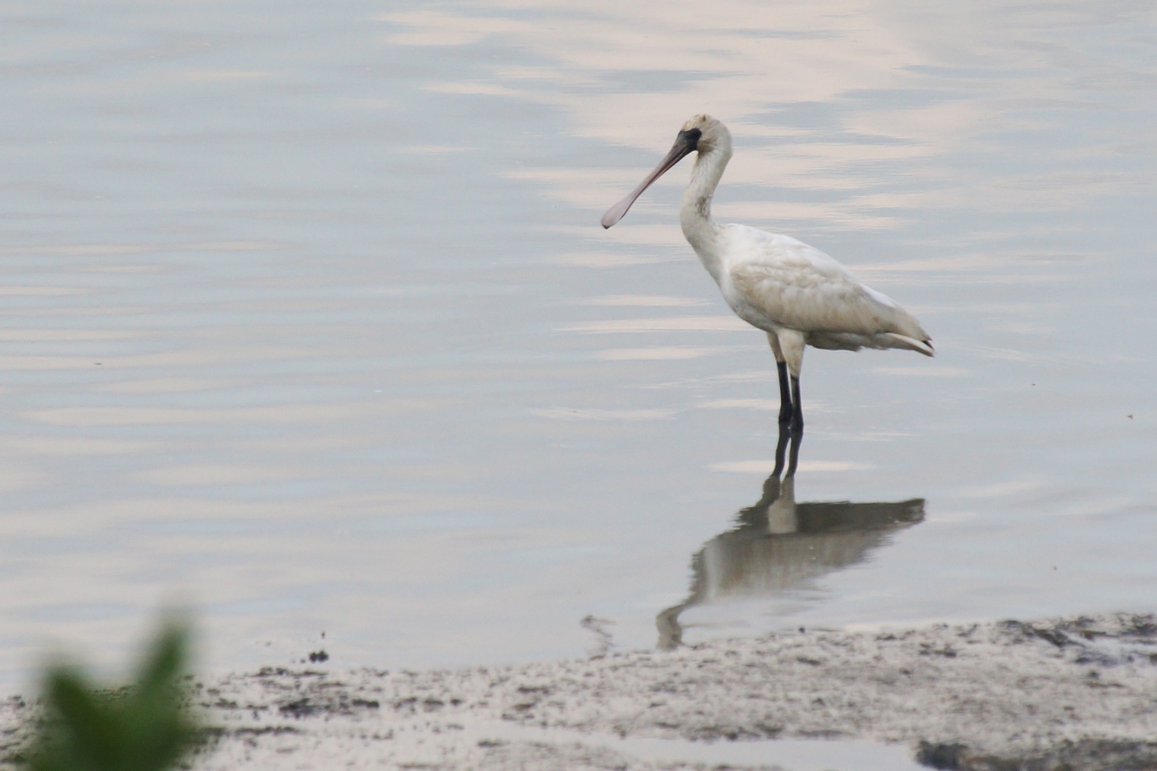
The Rare Bird Black-faced Spoonbill Feeds in Kam Tin River Channel
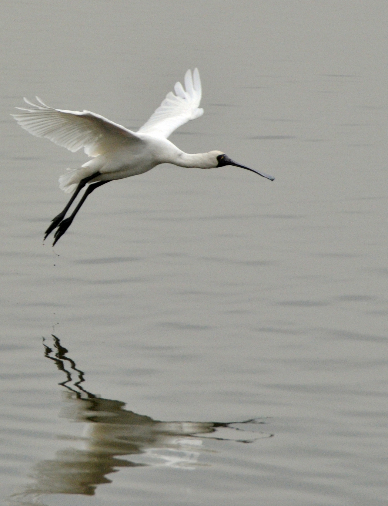
A Black-faced Spoonbill is Flying Elegantly
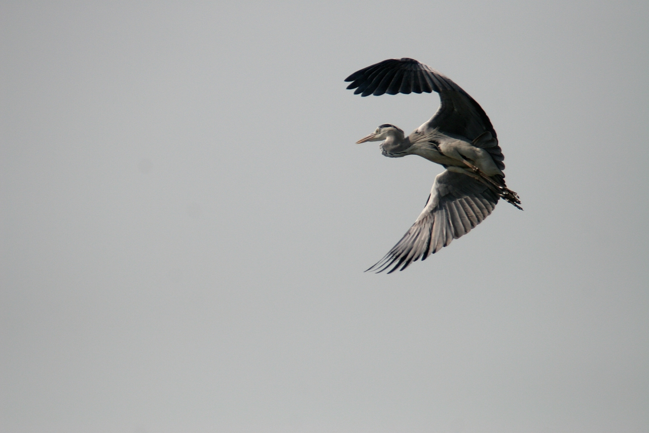
A Grey Heron Takes Flight
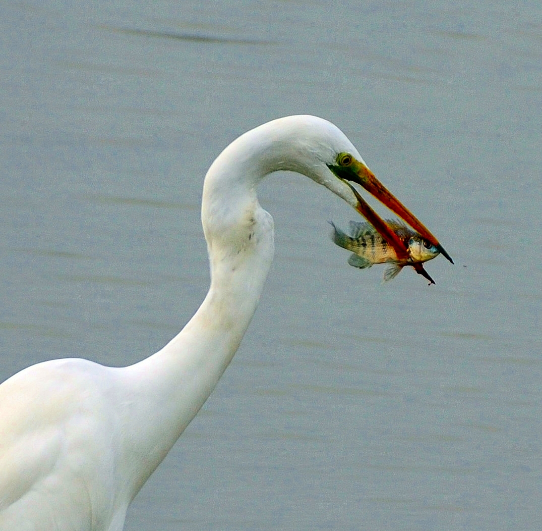
Great Egret the Great Fisherman
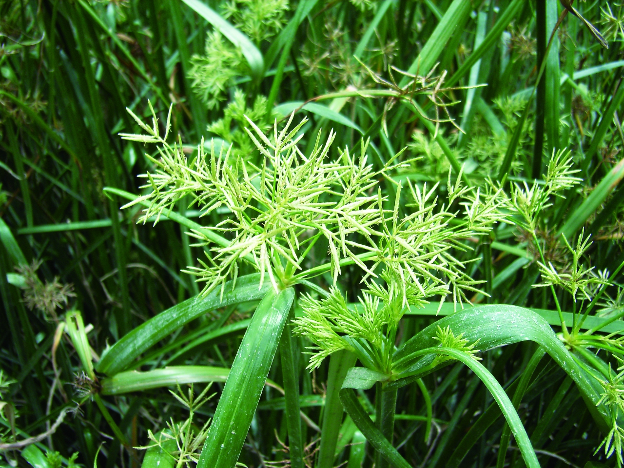
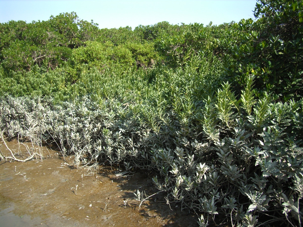
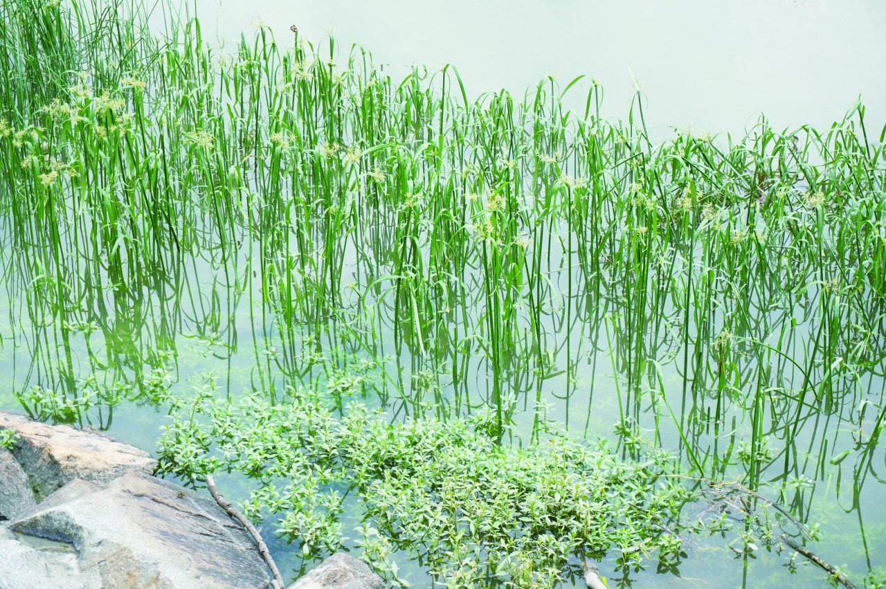
Short-leaved Malacca Galingale
Audio Guide
Short-leaved Malacca Galingale (Cyperus malaccensis Lam. var. brevifolius Boeck.) grows between sea water and fresh water. It is therefore commonly known as "salt water grass" in Chinese. It was important for making everyday items in the 1950s and 1960s.
The stem is the part that was used by people. After drying, Short-leaved Malacca Galingale can be used as string. It is tough and flexible and fastens items firmly. Dried Short-leaved Malacca Galingale was once a daily necessity as it could be used to tie vegetables into bundles and dumplings, and to plait hats as well. During 1950s and 1960s, Hong Kong imported over 100,000 catties of dried Short-leaved Malacca Galingale from Dongguang every year to meet the high demand. Sai Ying Pun was once a noted place for selling Short-leaved Malacca Galingale. However, it became obsolete when people began to use plastic bags. There is only a shop, probably the last, still selling Short-leaved Malacca Galingale in Sai Ying Pun.
Short-leaved Malacca Galingale, a member of the genus Cyperus of Family Cyperaceae, is a perennial herbaceous water plant. The triangular stem, which may be as tall as 1 metre, is a key feature of the family. The flower cluster bears 5 to10 flowers of different lengths, arranged in a radial form. The real leaves are at the base of the stem, rather than being the conspicuous bracts below the inflorescence. Generally, Short-leaved Malacca Galingale can be harvested twice a year. It is distributed over south China coast, Taiwan, Japan and Vietnam. In Hong Kong, it is abundant in Deep Bay and Sha Tau Kok.
Short-leaved Malacca Galingale Grows by the River
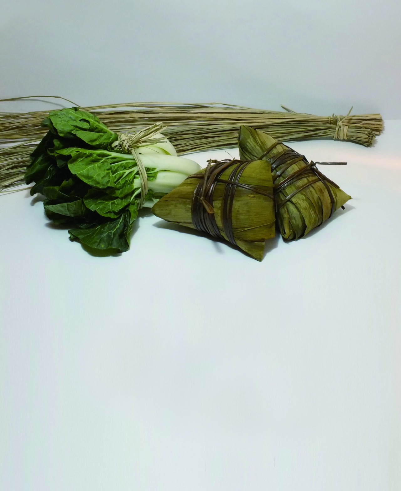
Short-leaved Malacca Galingale has Various Uses
The Confluence of the Old Natural Channel of Kam Tin River (left) and Shan Pui River (right)
Audio Guide
If you look towards the direction of Yuen Long Town centre, not far from here is the confluence of the old natural channel of Kam Tin River and Shan Pui River. Before the river training works, the confluence of Kam Tin and Shan Pui River was to the south of Nam Sang Wai instead of to the north as at present.
The river environs was more prosperous in the past. The village, Shan Pui Chung Hau Tsuen, was established beside the river, and stilt houses are still found along the riverbanks today.
During the Ming Dynasty, Shan Pui River was deep enough for navigation. During the Qing Dynasty, people travelled between Lantau Island and Yuen Long by small boats. There was once a boat factory nearby making wooden boats and paddles. Navigation contributed to the establishment of Yuen Long Market, which is now called Kau Hui, the Old Market. It was more prosperous here in the past. Shan Pui Chung Hau Tsuen (a village) was established by the river, and stilt houses can still be found along the riverbanks. In the early 20th century, land transport gradually replaced navigation by river channel, as Castle Peak Road was connected to Yuen Long and the river channel became increasingly shallow. Today, there is basically no waterways travel along Shan Pui River.
The estuary is a rich fishing ground. In bygone days, fishermen set up stake nets on the mudflats at the Shan Pui River estuary to catch fish that swam into Deep Bay as the tide ebbed, e.g. Yellowfin Seabream (Acanthopagrus latus) and Japanese Eel (Anguilla japonica).
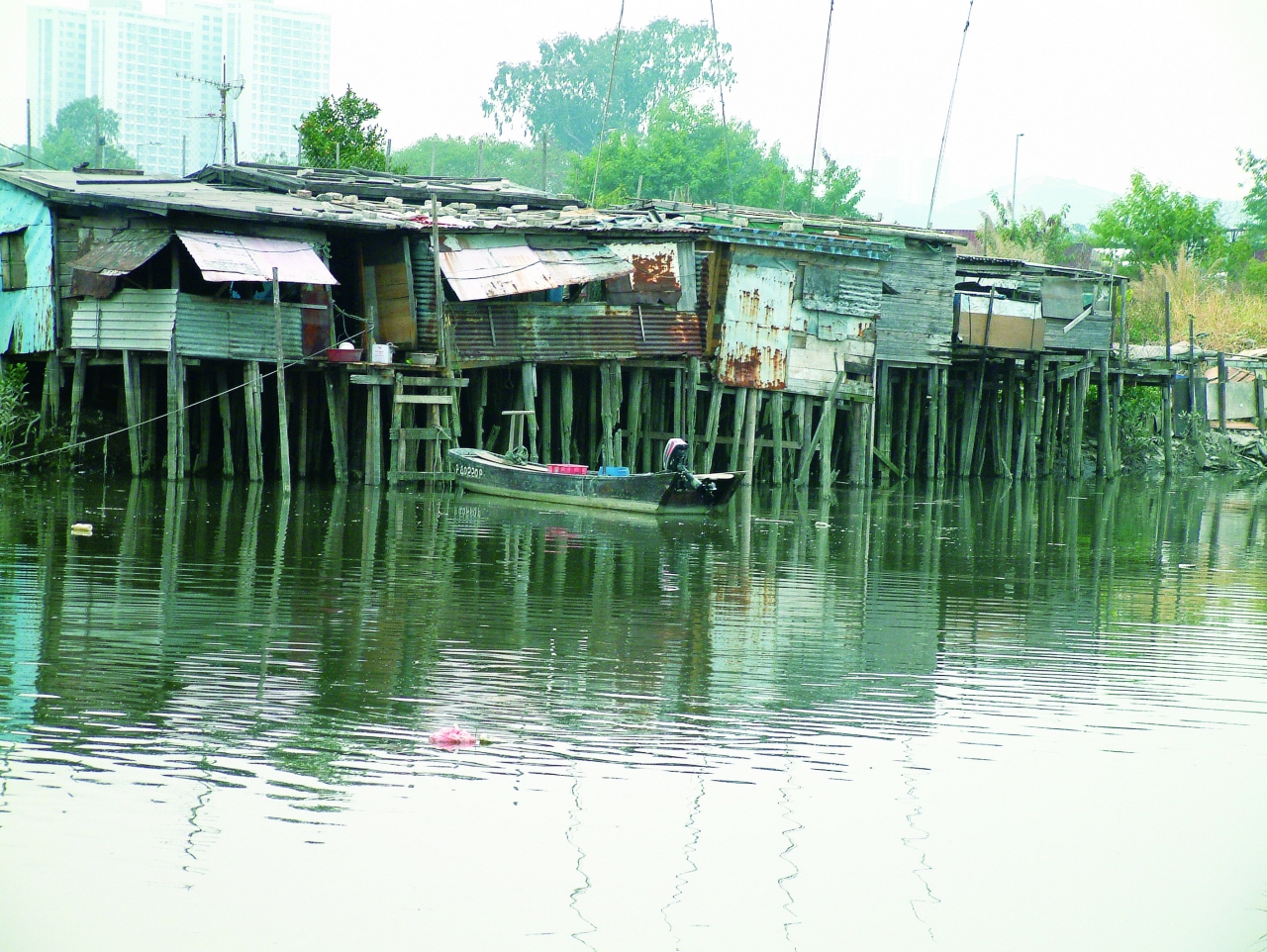
Stilt Houses at Shan Pui Chung Hau Tsuen
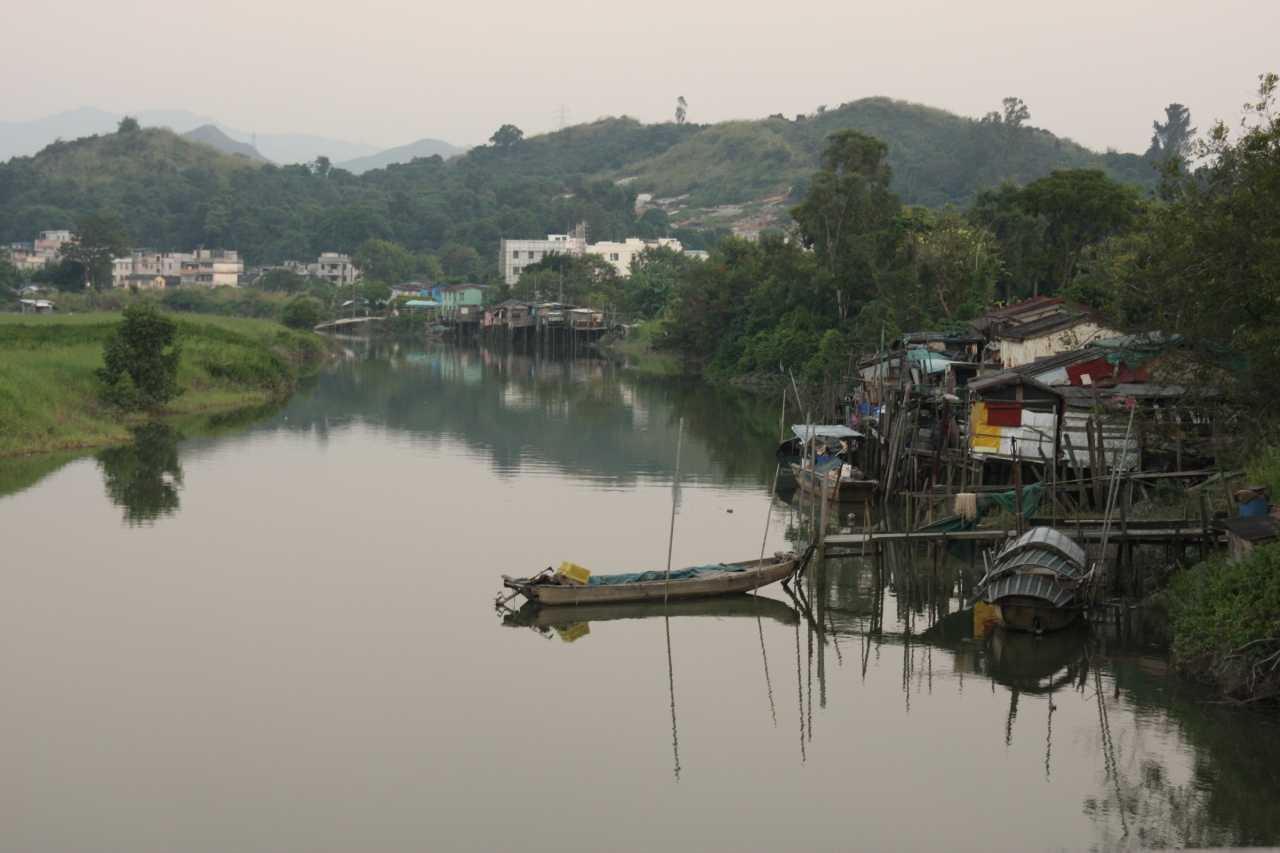
Shan Pui Chung Hau Tsuen was Established by the River
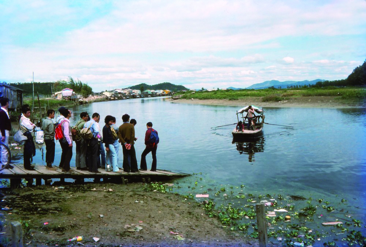
During the Qing Dynasty, People Travelled between Lantau Island and Yuen Long by Small Boats via Shan Pu
A Hand-pulled Boat at the Old Kam Tin River Estuary in the 1970s (Photo by Howard Leung)
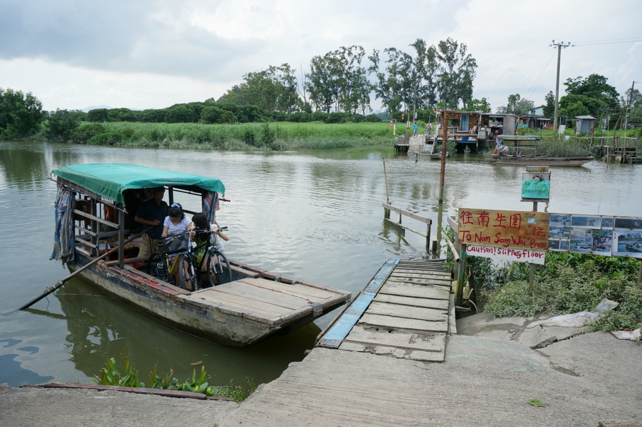
Hand Pulled Boat are Used to Cross the Old River Channel of Kam Tin River
![]()
© Copyright by Green Power